
Sunday, September 3, 2000 - LaSalle to Carbon Cliff
After covering the eastern portion of the GIT in one overnight trip and two day rides, I set out with my wife to complete the loop. I rode with panniers containing the same things that I would carry on a solo tour except for street clothes and toiletries. My wife carried those in our car. I still don't know how I got her to agree to do this for our vacation, but it worked out pretty well. I rode during the day while she went sightseeing, then we met up for dinner.
On Saturday afternoon we had driven out to LaSalle, where I had finished the Illinois & Michigan Canal Trail two weeks earlier. I planned to ride to the Quad Cities on the first day, mostly tracing the Hennepin Parkway Canal Trail. Unfortunately, I was unable to follow the canal closely because most of the trail was closed for construction. The trail was being improved from grass to crushed limestone or oil and chip surface. By crisscrossing the canal and zigzagging all the way out to the Quad Cities, the alternate road route added many miles to my trip.
After a heavy breakfast at Bob Evans, we drove to Lock 14. As I took my bike off the rack, some older local guy in a pickup truck started talking to us. He said we should get a tandem bicycle and ride together. He rambled on and on about all sorts of things. Finally, he got it out of his system and went on to bug someone else so I could get ready to ride. As far as I could tell, he just hung out there talking to people. At 9 AM, I began my quest to finish the second half of the GIT. I started on Canal Street following the I & M Canal feeder toward the Illinois River.
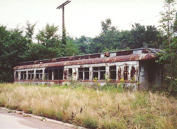
This train car was abandoned in LaSalle.
I rode out of LaSalle-Peru on US 6. I didn't expect any hills today, but I hadn't considered the Illinois River valley. My first thrill of the day came as I descended toward the Spring Creek bridge east of Spring Valley. West of town, I missed a turn and ended up riding shoulderless Illinois 29 to Depue. The route through the center of Depue was pleasant, but the climb back up toward IL 29 was wicked. The road turned to gravel, and I had to drop into my second lowest gear to pull my loaded bike and myself up to the top. Sometimes I use hills like that as a gut check and crank hard up them, but it was too early in a long day for that. I headed down IL 29 to Bureau, where bridge repairs were being done over the Hennepin Canal (the canal was dry, but a lock was visible to the west) and Bureau Creek. After the second bridge, I almost missed the right turn onto County 23. The GIT cue sheets listed numerous county route numbers on the Bureau Junction to Quad Cities segment, but in fact few if any of those numbers were actually posted on the roads. Most existed only on maps, as was the case for County 23, which was signed as " 910N" at IL 29. This turned out to be one of the most scenic roads on the entire GIT. It twisted alongside Bureau Creek for about eight miles, ending up in Tiskilwa.
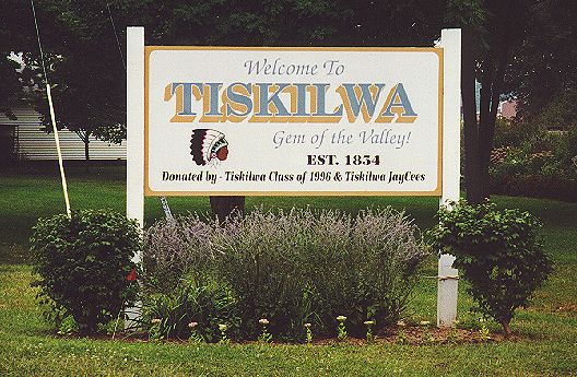
Tiskilwa was the " Gem of the Valley!"
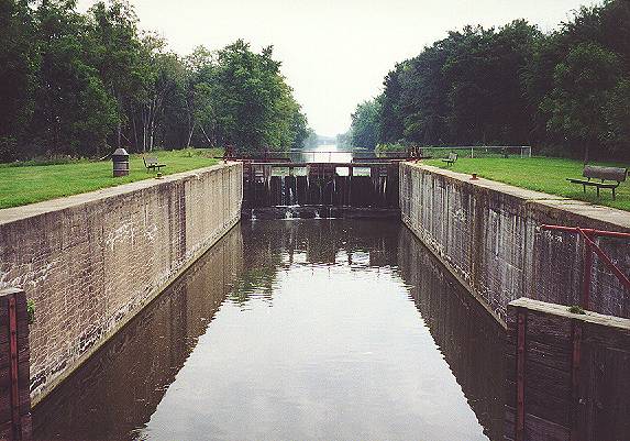
At this point I deviated from the cue sheet because I couldn't find the road listed. As I charted my own course north, it began to rain. A steady drizzle came down for the next ten miles or so. At one point on Wyanet-Walnut Road (when I got back on track) it came down pretty hard. This was not fun. However, my spirits brightened as I crossed a steel truss bridge over the Hennepin Canal. On the north side of the bridge was a Hennepin Canal day use area. I was excited to see that the Hennepin's locks were in much better condition than those of the I & M Canal. I would attribute this to several factors:
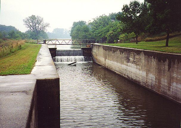
The Hennepin Canal locks looked like new compared to the battered I & M Canal locks.
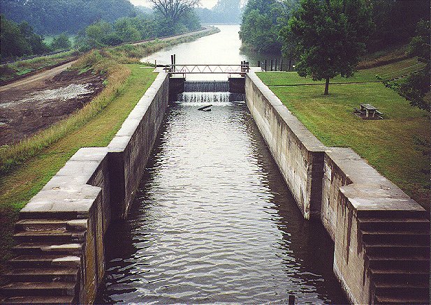
This view from above was taken from a nearby highway bridge.
Since I was a bit ahead of schedule, I took some time to walk around. I could see the work being done to improve the trail on the south side of the canal. There was a house nearby and a foundation, but no explanation of whether their use had been related to the canal, such as for a lock tender’s house. The interpretive signs gave some interesting information about the canal's relatively brief heyday. Unfortunately, the other day use areas had identical signs. I would have rather seen information specific to each area.
The rain stopped, but I put on a jacket to lessen the wind chill. One thing to remember about cycling is that " comfortably cool" on foot can translate to " freezing cold" on a bike. The road skirted the western edge of Wyanet, crossing the Burlington Northern railroad tracks on a new bridge. I headed west on US 6/34. Traffic was lighter than I expected, and drivers were polite. At Illinois 40, I left the GIT route to visit Hennepin Canal Parkway State Park. I was a little annoyed that the cue sheets skipped past some of the GIT checkpoints (I feared that I would forget and miss a checkpoint), but the checkpoints would all be on the GIT when the actual trails were finished.
I rode into the park around 11:45 AM, comfortably ahead of the 12:30-1:00 timeframe I had told my wife. After taking the traditional photograph of my bike leaning against the state park sign, I met up with her in the parking lot. We went into the visitor's center, definitely worth seeing. A small museum there gave a lot of historical background. A very knowledgeable DNR employee answered my many questions about the history of the canal and the current condition of the trail. She struck me as a real student of history, as opposed to someone who was " just doing her job."
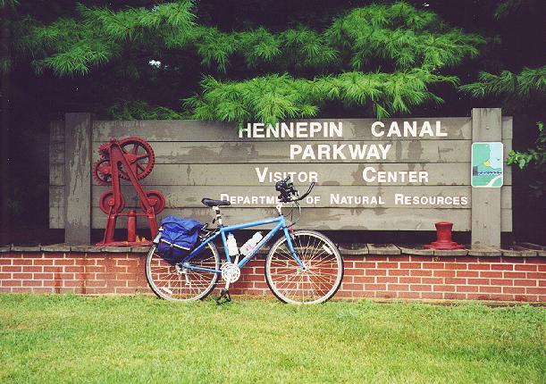
I parked my bike for the now traditional checkpoint photo.
Back in the parking lot, I took advantage of my support vehicle and changed into dry clothes. I put the bike on the rack and we drove to a restaurant near Interstate 80 for lunch. Although the sign out front touted " new management," the food was greasy and not very good. Perhaps they needed a new cook more than new management! After lunch, we drove to the intersection of IL 40 and US 6/34 where I had departed the GIT. It had been a much longer rest stop than I had intended. Although I would be racing the setting sun, I kept my goal set for the Quad Cities. We decided to meet in Carbon Cliff, near East Moline. I removed my bike and finally got back on the trail around 2:30.
The sun came out, making the afternoon seem like a different day. Most of the roads were rural, though I occasionally passed through small towns like Mineral, Annawan and Atkinson. I crossed back and forth over Interstate 80 several times and missed a turn or two but stayed more or less on track. I entertained myself on some of the flat, straight stretches by trying to dodge the many fuzzy caterpillars in the road. I noticed that there were brunette, blonde and red-haired caterpillars, which made them seem like people. Yeah, it was a bit lonely out there!
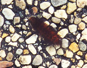
This was one of the many, many caterpillars I saw on the road.
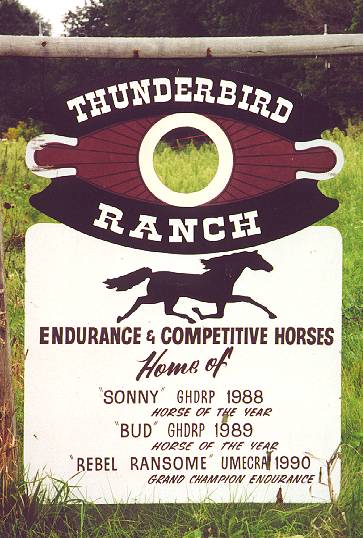
On a backroad in the middle of nowhere, I spotted this sign for a champion horse ranch.
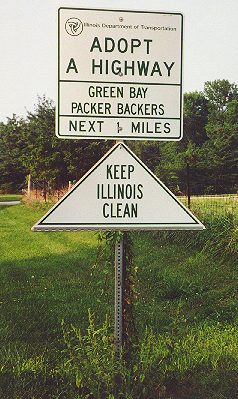
Hey, this isn't Wisconsin!
The big highlight of the afternoon was a Hennepin Canal day use area that had a lock and a bridge. Though now stationary, the bridge was originally raised and lowered for canal ships. I wandered around for a while and took lots of pictures.
This lock was in even better shape than the previous one.
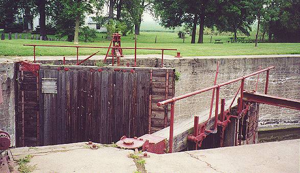
Here is a better view of the brawny lock gates.
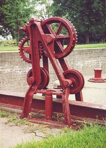
These gears once opened and closed the lock gates.
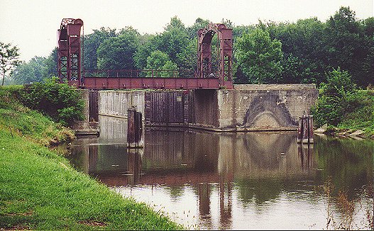
This view shows the bridge that was part of the lock.
There was also a new trail underpass nearby where a road went over the canal, apparently constructed as part of the trail improvement project. Although it wasn't officially open, I rode through anyway.
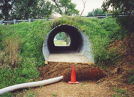
This tunnel was part of the upgraded trail.
The only large town before the Quad Cities was Geneseo.
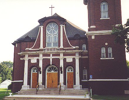
I'm pretty sure this church was in Geneseo.
West of Geneseo, I came upon another day use area with a steel canal bridge. This one was covered with graffiti, a sorry testament to its proximity to people. Since the sun was setting and this area was crowded with fishermen, I didn’t linger for long.
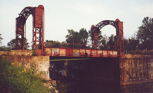
I was disappointed to see that vandals had " tagged" this neat bridge.
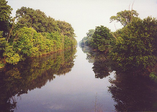
This was an especially pretty stretch of the canal.
Soon I reached Colona, where I saw a section of the Hennepin Canal Trail that was asphalt. Unfortunately, I was running late, so I didn't have time to ride on it. Instead, I rode over the Rock River on the IL 84 bridge (the first of four times I would cross that river on the GIT). This long four-lane bridge looked fairly new and had ample shoulders. Crossing a long, narrow bridge on a bike is one of my least favorite things to do, so I was happy to have plenty of room.
My wife and I had agreed to meet where IL 84 turns north from Colona Road. When I got there, however, I didn’t see a place where she could park and wait. That was the danger of agreeing to meet somewhere neither of us had ever been! I panicked a bit, wondering if she was lost and how we’d find each other. With a shrug that masked my fear of not finding her, I headed north on IL 84, then east on a side street to follow the GIT. I was thrilled to see our car parked there. She hadn’t known that side street was even on the GIT it was pure luck that our paths crossed. I mounted the bike on the car's rack and drove across the Mississippi to spend the night in Davenport.
Sunday was a good, solid day of riding. I went 94.5 miles at a 15.2 mph average speed. By this point in the year, I had done a number of centuries and could manage the distance easily enough that I could recover and ride the next day. It made me wonder how my first weekend of touring on the GIT would have gone if it had been Labor Day weekend instead of Independence Day weekend.
![]()
![]()
![]()
Copyright © 2002-2013 David Johnsen. All rights reserved.