
Saturday, August 19, 2000 - Channahon to LaSalle… and Back
On a beautiful Saturday morning, I drove out to the Illinois & Michigan Canal Trail access at Channahon to revisit one of my favorite trails and continue my Grand Illinois Trail quest. Unfortunately, circumstances dictated that this would be a one-day trip. I set a goal of following the trail and the canal to their western terminus at LaSalle, some 50-55 miles away. To add to the challenge, I carried my panniers. Although I did not pack for an overnight, I carried a fair amount of gear--tools and parts, jacket, emergency supplies, etc. This was my first tour sans handlebar bag my new aero-bars took up the space where that had been. Aside from a little extra hassle to get to my camera, I didn't miss the bag. Normally my GIT cue sheets would be in the bar bag, too, but I didn't need any for this trip--just follow the canal.
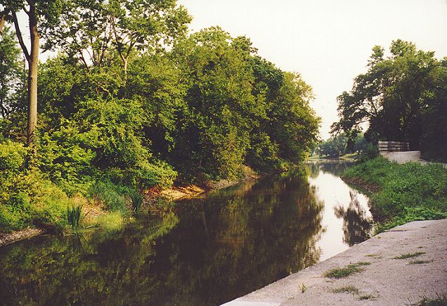
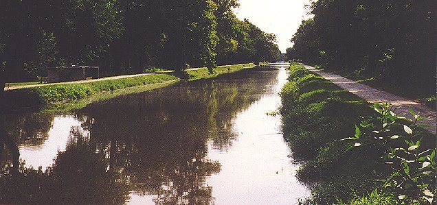
The I & M Canal at Channahon looked serene in the morning light.
I hit the trail between 7:30 and 8:00. I headed east first so that I could see some of the route that I had missed in a bonking daze a month earlier. After three miles, I turned around and headed west, my general direction for the next six hours. I had run and biked on this trail many times, but I still stopped a few times to take pictures on the way to Morris. The most notable things on this segment of the trail were the lockmaster's house and the aqueduct over Aux Sable Creek. Although some restoration work has been done to the lock, there is no water flowing through it. At least the aqueduct, one of four on the canal, was functioning.
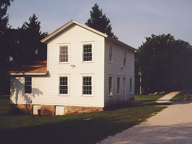
This was the locktender's house in Aux Sable.
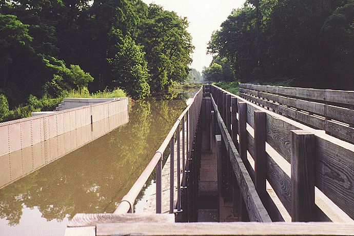
This aqueduct carried the I & M Canal over Aux Sable Creek.
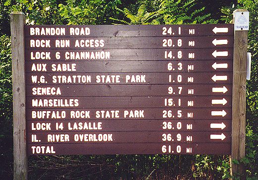
In the six months since I had last run along the canal, the trail had been enhanced with excellent mile markers. Not only did these markers give a mileage, but they also had the distance to the next landmark or town, plus a short paragraph about the fascinating history of the canal. If I had been running or hiking, I would have read every one of them, but on the bike it would have been kind of a hassle to stop every mile. Since the I & M had always been one of my favorite trails, I was happy to see it getting even better.
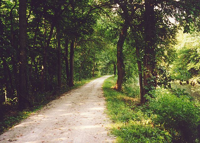
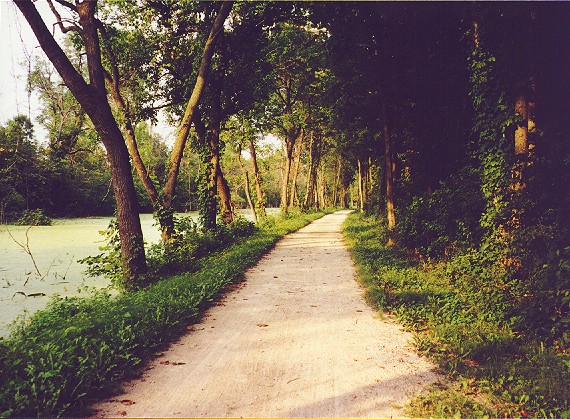
This was a typical view on the shaded path toward Morris.
In Morris, I ventured into town for something to eat. There was a nice gateway park at the foot of Liberty Street that detailed the struggles of Morris' founders.
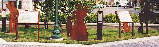
This park served as the gateway between the canal trail and downtown Morris.
Up the street, I saw the old Morris train depot, apparently unused for some time. The Morris Bakery had awesome cinnamon rolls--sweet and loaded with cinnamon, yet not too heavy.
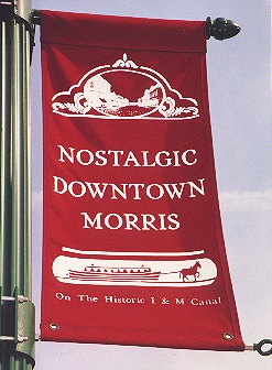
Like other towns along the I & M, Morris was proud of its canal heritage.
I headed back to the I & M Canal. In college I once rode the trail from Channahon to Morris and back, but from this point on, I would be covering new ground. The first GIT checkpoint of the day came soon after, at Gebhard Woods State Park. This park was special because it was the only part of the I & M Trail that had towpath trails on both sides of the canal.
Towpath trails ran on both sides of the canal at Gephardt Woods State Park.
There was also a silly little man-made waterfall, the second one I had seen on the GIT (the first being at McCormick Place on the Lakefront Trail). After munching my sweets and drinking an orange juice, I left the state park around 10 AM and continued west toward Seneca.
I still had 37 miles to go before I could turn around.
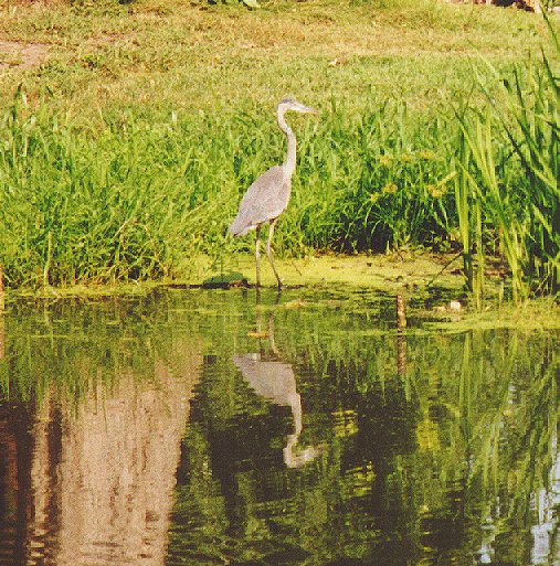
This was my best wildlife sighting for the day, a blue heron west of Gephardt Woods.
The major landmark in Seneca was a red grain elevator. The Hogan Grain Elevator was built in 1861 and operated into the 1980's, outliving the I & M Canal by half a century. In 1876, it shipped 900,000 bushels of grain.
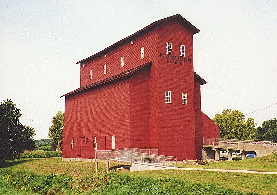
The Hogan grain elevator was the most prominent sight in Seneca.
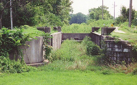
There were about five railroad crossings between Seneca and Marseilles, mostly spurs to factories along the Illinois River. At the east end of Marseilles I took a few pictures of Locks 9 and 10. The photo of me on the main page was also taken at Lock 9.
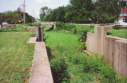
The canal was dry in Marseilles, and Locks 9 & 10 were full of weeds.
This view looks back east at Lock 9.
I saw a mural just before I ducked under a bridge over the canal bed.
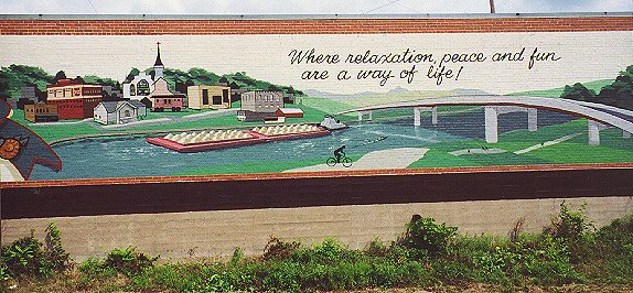
This wall mural in Marseilles showed a huge Illinois River barge along with the I & M Canal Trail.
On the west end of town was an old railroad swing bridge. It was built in 1887 to give rail access across the canal to factories near the river.
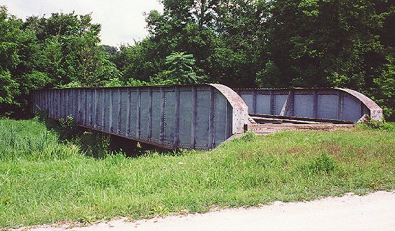
This was the old swinging bridge over the canal.
Since the canal bed was dry, I went underneath the bridge.
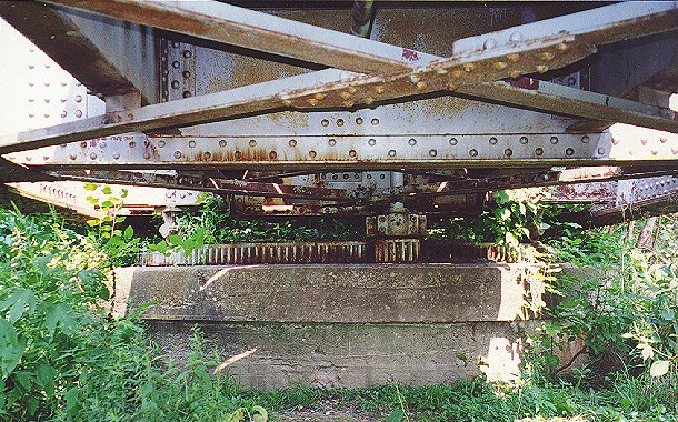
The underside of the swinging bridge revealed the gears that made it work.
Between Marseilles and Ottawa, there were many curves in the usually straight trail. This was the most fun part to ride. In Ottawa, the canal once crossed the Fox River on a huge aqueduct that was considered by locals to be the eighth wonder of the world. There is a structure there now, but it doesn’t carry water. I later learned that the trail bridge was once a railroad bridge for the Chicago & Illinois Valley freight belt line.
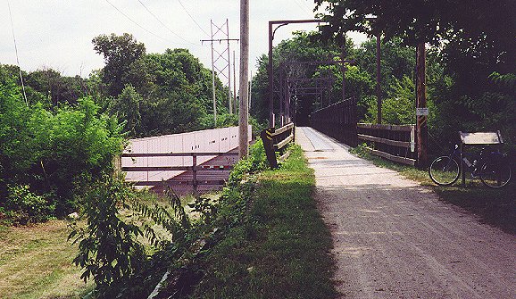
The trail bridge over the Fox River is on the right, while a dry aqueduct is on the left.
There wasn't much chance of the canal itself being refilled with flowing water in Ottawa (at least not deliberately) since the trail dropped into the canal bed to go under two Illinois 23 bridges. There were two more locks between Ottawa and Utica, Locks 11 and 12.
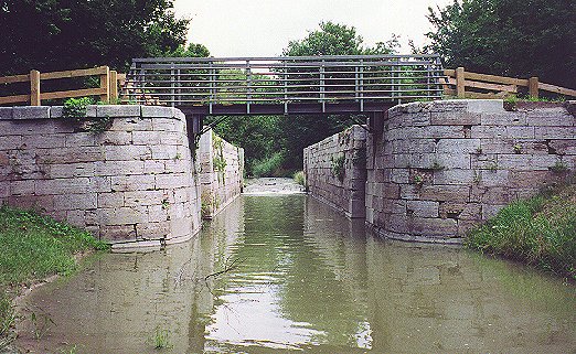
Lock 12 was spanned by a trail bridge.
In Utica, I rode around town and made note of several restaurants, then headed west.
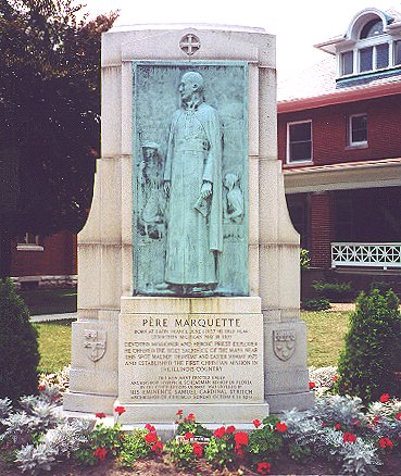
There was a monument honoring Pere Marquette in Utica.
I was almost finished with the outbound journey only LaSalle remained. There was green, stagnant water in the canal west of Utica, but there were a few interesting sights. Split Rock was once a huge formation that was blasted in half by canal builders the old fashioned way--with black powder. Also visible from the trail was a tunnel that the railroad had blasted through the rock years later with dynamite. Although I did not see any traces of it, an electric railroad once ran across the canal on a bridge there. It offered service between Joliet and Starved Rock State Park.
I came into the Lock 14 day use area in LaSalle around 1:45 PM, but I rode straight through. I wanted to get to the end of the trail first. It was obvious that this part of the trail was not frequently used, as weeds encroached from both sides. Mile marker 96 said " End of Trail 400 feet." A square patch of concrete with half a dozen park benches marked the end of the line. At this point, the water was deep enough for shipping, so the canal's mission, to provide a navigable water route from Chicago to the Illinois River, was accomplished.
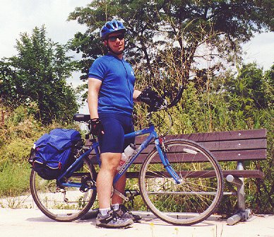
I paused and posed for a photo at the end of the trail before turning back toward Channahon.
It seemed rather strange for the trail to simply dead-end, and indeed, I wanted to go further. In this case, it was a good thing that I could not because I was already around 67 miles for the day. After subtracting the six miles I rode before heading west from Channahon and several short detours, I was about 55 miles from the car. I still felt relatively fresh, but I was going to run out of daylight. Of the six hours since Channahon, I'd ridden about 4:40:00 for a 14.3 mph average. For a loaded bike on crushed limestone, that wasn't bad. Still, I would not be able to stop for as many photos on the way home.
On the way back, Lock 14 was a real treat, a fine reward for the historically minded canal trail traveler. After seeing so many locks in various states of disrepair and dilapidation along the way, I was thrilled to see that Lock 14 was restored to show how a typical canal lock worked, complete with all the gates and levers. The only thing better would have been a live demonstration.
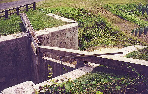
Lock 14 had beautifully restored gates.

Here is another view of Lock 14.

The gates were holding back this green muck.
Back in Utica, I stopped at a place called the Country Cupboard for pizza and ice cream. The pizza wasn't anything special, though I'm sure it didn't help that the slices had been sitting in the warmer for a while. I was hungry enough that it didn’t matter. After lunch, I had an Oreo flurry (like a DQ Blizzard). Sure I was living it up, but I needed to store some energy. I had 50 miles to go. There had been a light 5-10 mph wind from the east all day, and now I had to face it. I was glad to have the aero-bars. By crouching on the aero-bars, I could shift to a higher (faster) gear without working any harder.
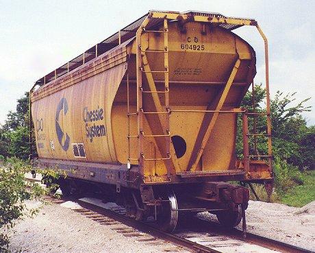
West of Ottawa, I photographed this railroad car.
Soon I was in Ottawa. I stopped to look at an old building, but I couldn't determine its original purpose. It looked a bit like a jail, but I didn't think the window grates were part of the original structure.
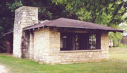
This neat stone building was alongside the trail in Ottawa.
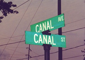
Meet me at the corner of Canal and Canal... by the canal!
My four water bottles were completely empty, so I stopped at a gas station for water, an orange juice and a bag of Cheez-Its, a sodium-replenishing food I “discovered” on my last century ride (Cheez-Its never before tasted as good as they did at the 80-mile mark on that century ride). Orange juice was the magical fluid of this ride. I read an article in the Adventure Cyclist magazine archives about how Race Across America riders often drink orange juice instead of sports drink, and I think that is what really helped me beat the bonk. I consumed five 8-ounce servings throughout the day. However, I do not recommend chugging 16 ounces of juice and hopping on the bike I felt awful for the next ten minutes or so. As I prepared to leave the gas station, I noticed a train depot across the street. It looked run down, but not as badly as the Morris station. Architecturally, it was a gem.
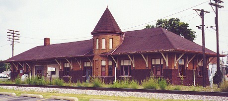
I hoped that the old Ottawa railroad station would be reborn someday.
The trip back was quick and uneventful. I spent a lot of time down on the aero-bars to beat the headwind and make up some time as the sun went down. In Ottawa I hadn't bought enough water, so I topped off my bottles in Seneca.
The crushed limestone trail took on an orange glow from the setting sun.
At William G. Stratton State Park on the east side of Morris, I gave myself one last pep talk and headed for Channahon, stopping only to see the red mule barn in Dresden, the only structure left in Dresden, as far as I could tell. The barn once housed the mules that pulled barges up this very towpath I was riding on, but the town was abandoned after the canal's heyday.
I had one small dilemma: my mileage was destined to be around 110-115, but I felt good and didn’t want to stop yet. This was a nice “problem” to have. I had been planning on doing a double metric century ride the next weekend anyway... " Just another ten miles!" I told myself as I blasted past the parking lot and through the town of Channahon. I was going to get my double metric easily, as long as I could see the trail. I could have pedaled all the way to Joliet, but it was nearly 8 PM. When the odometer hit 120, I turned around. I cruised with the wind at my back once more, but when I headed back into the woods, I had to slow down. It was pretty dark, yet I had to keep my sunglasses on to prevent the thickening clouds of bugs from getting in my eyes. I was glad that I had just covered this section of the trail a few minutes earlier. At least I knew that the trail was relatively smooth and clear of obstructions, even though I couldn't see it very well. Just to be safe, I stayed off the aero-bars. If I did hit something, such as a pit or a stick, I wanted to have good steering and balance. Fortunately, everything went fine aside from one bug that slipped around my shades. I charged down into the parking lot, pulled up to the car and checked the cyclometer. 126.75 miles in 8:35:40 for a 14.7 mph average, up from 14.3 mph at LaSalle. Best of all, I really felt great. It was a major personal victory for me after my first two touring outings ended with bonks of some degree. Managing food, water and electrolytes was the biggest challenge for me on distance rides. My legs could spin the pedals forever, but not if I ran out of energy. This time I did it right.
![]()
![]()
![]()
Copyright © 2002-2013 David Johnsen. All rights reserved.