
Sunday, July 16th, 2000 - Chicago to Channahon
This leg of my journey was spontaneous. On Saturday night around 11 PM, I got the idea to ride this as an “easy” 60-70 mile weekend ride. I planned to ride one-way and have my wife drive out to meet me for dinner and take me home. As I packed my panniers, there was a problem... I had misplaced my maps. I decided to ride somewhere else Sunday morning instead and went to bed.
On Sunday I woke up around 8:30 AM. I looked one more time for my maps... and I found them! Unfortunately, I had already slept through the cool, quiet early morning hours, but I still had time to ride to Joliet, maybe even Channahon. I hurried to gather all of my touring gear, but as usual, it took longer than it should have. I wheeled my loaded Cannondale H-300 out the door a few minutes before 10 AM. Because I figured the Lakefront Path on the North Side would be crowded, I took city streets down to Navy Pier.
I reached Navy Pier, the sort of home base of the GIT (this was where the trail was officially unveiled six weeks earlier), around 10:30. There were already crowds of people enjoying the warm, sunny summer day. Since I had been to Navy Pier many times, I paused just long enough to snap a few documentary photos and check my odometer: 8.23 miles from home. According to my GIT cue sheets, it should have been another 60 miles to Joliet.
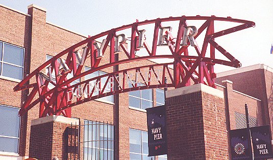
Navy Pier was where the GIT was formally announced in June 2000.
I followed the familiar Lakefront Path south from Navy Pier. One of the worst parts of the trail is where it runs on the sidewalk of lower Lake Shore Drive. Not only is oncoming traffic just inches away, but to make matters worse, support columns obstruct the sidewalk. It's merely annoying to dodge them on foot, but on a bicycle they are downright perilous. There must be dozens of accidents or close calls every day. The path continued to be crowded as I went south through Grant Park and the Museum Campus. Beyond McCormick Place, I encountered fewer people. Around Hyde Park, there was a detour that led me west over Lake Shore Drive, down another bike path, and then back east under Lake Shore Drive near the Museum of Science and Industry. I think this had something to do with the huge multi-year U.S. Army Corps of Engineers lakefront reconstruction project.
The Lakefront Path ended just past the South Shore Cultural Center, but the bike route continued onto US 41. The L.I.B. cue sheets had an alternate with lower traffic, but U.S. 41 was okay at 11 AM on a Sunday. There was some traffic, but when balanced with the no parking zones (i.e., no car doors to worry about), it was fine. There were a few confusing intersections, such as 95th Street where US 12 and US 20 come into US 41. I was supposed to angle southeast, but instead I went south for a block or two. Realizing my mistake, I turned east and got back on US 41. At 104th Street, the Burnham Greenway suddenly appeared. This rail trail was so new that the railroad rails were still embedded in US 41 at its north end. It was nice to get off the city streets, but this trail lasted only a few miles and had many street crossings.
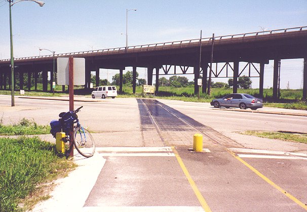
Only the rails in US 41 remain from the railroad that is now the Burnham Greenway. The elevated highway in the background is the Chicago Skyway.
I took a spur to the east that brought me to a park road in William Powers State Natural Area. Heading south again, I came to a parking and picnicking area next to Wolf Lake. There were many fishermen, with and without boats. I photographed some purple wildflowers on the edge of the lake.
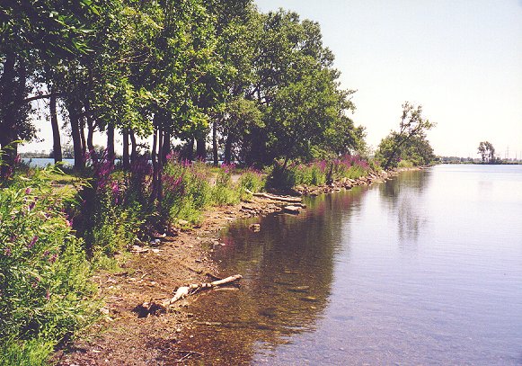
Wolf Lake is a popular fishing spot near the Indiana state line.
The biggest surprise of the day was nearby. During the Cold War, this area had been a Nike defense missile site (no relation to the “Just do it” folks, of course). There was an information kiosk and a Nike missile on a pedestal commemorating the site. The newspaper article posted on the kiosk was fascinating. This was one of nearly two dozen such missile sites in the Chicago area built in the 1950's. Their purpose was to defend against a Russian aerial attack on the region's industrial capacity. The sites were dismantled when the Cold War arms race rendered them obsolete.
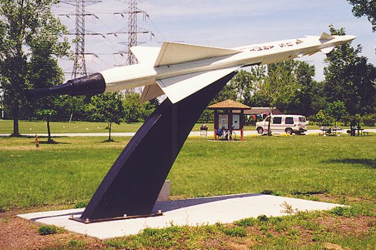
Nike missiles like this were prepared to defend Chicago from a Soviet attack.
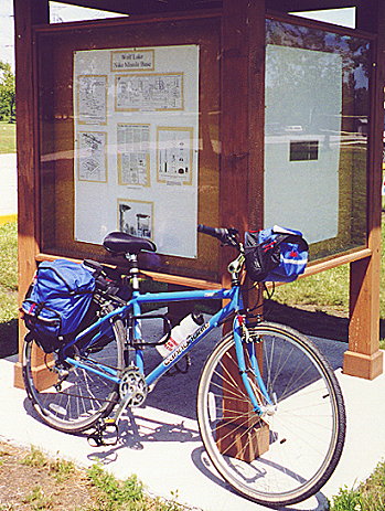
The Nike missile info kiosk was also a nice place to lean my bike.
After the unexpected history lesson, I continued down the park road to the office, reaching this checkpoint around 11:30 AM. From there, I headed out onto 130th Street for a half block of gravel to Avenue O. As I headed south on Avenue O, it turned into Burnham Avenue, a good thing since that's the road I was supposed to take. It was four lanes and traffic wasn't too heavy. After a huge bridge, the road narrowed at the next intersection, so I decided to follow the alternate route to another piece of the Burnham Greenway. The cue sheets led me back to State Street, but I couldn't find the trail. I took State southeast until I came to State Line Road. I knew I didn't want to go past and into Indiana (after all, this was the Grand Illinois Trail), so I headed south, straddling the border between Calumet City, IL and Hammond, IN.
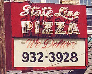
State Line Pizza was one of the businesses on State Line Road.
At 159th Street, I cut back west to Burnham Avenue. The message board for a restaurant tempted me with omelets (their specialty) and cinnamon-swirl French toast. Since I didn’t have the time to spare for a sit-down meal, I ate a granola bar instead. I continued south to 170th Street, then west to Chicago Avenue and south to Bernice Avenue where I went west, south under Interstate 80, then east again to Chicago Avenue and continued south. At 186th Street, I went west again and turned into a forest preserve. This led me to the Thorn Creek Trail. It was a nice change of pace from the city grid to follow the curves through wooded areas. I crossed Torrence Avenue and continued west on the trail, but when the trail turned sharply to the north at Glenwood-Lansing Road, I cut over to the street.
In Glenwood, I spotted a Dairy Queen in a strip mall and suddenly became very hungry. Dairy Queens tend to cause such a Pavlovian response in cyclists. Three-time Tour De France winner Greg LeMond was once asked what he thought about during bike races in Europe. He said, " Dairy Queen. God, I dream about Dairy Queens." Anyway, it was nearly 1:00 PM, I'd covered over 30 miles, and I hadn't eaten a real meal all day. In other words, I had earned it. I parked and locked up the bike. I noticed that the rack was not bolted to the ground, but I figured someone would have a hard time lifting the bike and the rack together. Besides, I planned to sit next to the window. I ordered a bacon double cheeseburger and a large Pepsi. While I was eating, a young boy said, " A racer!" I thought he was talking about the NASCAR driver on his Pepsi cup, but then he asked me, " Are you a racer?" For an instant, I pictured myself riding with Lance Armstrong in the Tour de France (which was going on at the time). But alas, I had to confess that I was merely a bicycle tourist, and that that loaded-down moose outside was my ride. I think the boy was disappointed.
After lunch, I headed back out onto Glenwood-Lansing Road. In a day full of navigational difficulties, I soon made the one of the worst errors of the day. In retrospect, an impending railroad crossing must have distracted me. Anyway, I missed a left turn onto State Street that would have easily delivered me to Park Forest near the Old Plank Road Trail (OPRT). Instead, I went the hard way. In fact, I swept through a couple stoplights and turns of the road before I even realized my mistake. By then, on 187th just past Halsted, I didn't want to backtrack, so I dug out my trusty CBF map and looked for an alternate. Hmmm, Chicago Road looked okay, even though it cut a slight diagonal to the east. I could take that to 10th Street just before IL 1, then jog west to Campbell Avenue and south. That part went fine, but once I got on Campbell, I crossed over a somewhat busy highway. The south suburbs had a nasty trick of only labeling some of the major intersections, usually with only one of the two crossroads marked. Somehow, I sailed right across the Lincoln Highway without noticing. Campbell was a pleasant, tree-shaded ride, a rare reprieve from the sun. The road curved west at a forest preserve and I followed. The neighborhood was a bit depressed, but not too bad, especially on a sunny Sunday. I learned that I was on Beacon Boulevard as I paralleled a forest preserve area. When I reached Western Avenue, once again there were no signs to tell me so. My only clue was a business sign with a full street address. That's where I made the worst mistake of the day. The OPRT began just a few blocks north of Beacon. I turned south.
Looking back, I really should have consulted my maps more often. Since I rarely get lost, I trusted my intuition. This time my intuition was wrong. I pedaled down Western Avenue, which was fortunately not as heavily traveled there as in Chicago. Though I had already passed Lincoln Highway, I kept looking for it, always thinking that the next stoplight would be the one. Finally, I came to a road I knew: Exchange Avenue. Uh-oh. I wasn't lost I knew exactly where I was, and it was so far beyond where I was supposed to be that it was literally off the CBF map.
I bounced back surprisingly well from this upset. I just got back on Western and headed north, checking the map more often this time. I pulled into an abandoned shopping center and looked very closely at where the OPRT began. It was just a short distance away now, over the railroad tracks and a few blocks, not far from where I'd turned south onto Western. Two cars turned onto Western Avenue with me, just in time for an approaching train to bring traffic to a halt. To my surprise, the guy in the first car got out and headed back to the second car. " It's going to be a long one," he told the woman inside. Since he got in the passenger seat, I assumed they knew each other. I had plenty of time to wait and spent it stretching and drinking the last of my water. The man in the car ahead was right--this was a very long train. When it finally passed, I made a beeline for the gas station a block away. The store was small, but they had water and Gatorade, all I needed. I refilled two bottles, finished off the remainder of the water and put the Gatorade in my bottle holder. I needed an energy boost I had logged over 60 miles, already about as far as I should have ridden to Joliet had I not taken the “scenic” route. I turned onto the OPRT.
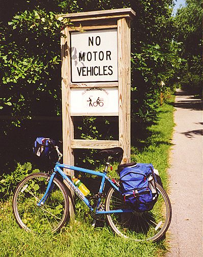
My bike was freshly loaded with a bottle of Gatorade for the ride down the OPRT.
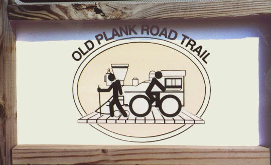
The OPRT had a logo that recalled its railroad origins.

The OPRT was a part of the American Discovery Trail, a cross-country hiking route.
The OPRT was smooth, paved and mostly straight. There were several in-town areas with successive street crossings, but few busy streets. After photographing the OPRT, GIT and American Discovery Trail signs, I headed down the path looking for my next checkpoint: " Village of Matteson--Caboose Park." I saw a school play area, but that didn't look like a park. There was a church with some green space, too. And near Governor's Highway I saw Governor's Park. No Caboose Park. As I passed a recumbent bicyclist, I asked him if he knew. He said the local bike club met there for rides, but he'd never been on those particular rides. I thanked him for trying to help and stopped at a gazebo labeled " Trail Depot" to see if the folks resting there had any clue. No luck. A map of the trail didn't help, either. Well, I tried to find Caboose Park, but I failed. I would have to go back sometime and find it to complete my GIT quest.
The guy on the recumbent (I forgot his name) came back to see if I'd had any luck. He asked if I was going to backtrack to look for it, but I said no because I was already behind schedule. Then he asked if I'd like some company for a while. I think many cyclists are intrigued by the sight of panniers. He was probably disappointed to hear that I had only come from Chicago. We talked about a variety of cycling topics, particularly his bicycle. He said it was only a month old and described some of the differences between a recumbent and a regular road bike. For one thing, he said it was nearly impossible to balance without moving. As soon as he took his feet off the ground, he had to start pedaling--a little too slow and he would fall over. He also said that although his hands didn't apply much pressure to the handlebars (under-seat steering), the bike was difficult to control with only one hand. This made it very hard to drink water from a bottle while riding. As we approached Frankfort, he told me about a little ice cream shop near the trail. I said I'd already had my ice cream for the day at DQ. Besides, I needed to keep moving toward Joliet. He was ready to turn around to head back to Homewood, so he said goodbye.
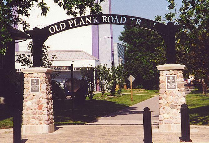
The village of Frankfort erected this arch over the OPRT.
Soon I came upon the architectural highlight of the OPRT: the stunning white bridge over US 45. I had heard about it, and it was indeed a sight to behold (unfortunately, I didn't get a good picture). West of Frankfort, the trail had fewer street crossings, and those streets appeared more like rural roads. I needed to call my wife to pick me up at the end of my route, but there was one problem--I couldn't find a telephone. In fact, I didn't find a phone until I got to the east side of Joliet on US 30. The first phone I saw had a cut cord, but the second one worked. I called at 5:30, when I had said I would call around 4:00.
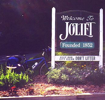
Joliet simultaneously welcomed me and asked me not to pollute.
It was here that I made another bad decision. Since it would take my wife more than an hour to come to get me, I figured that I should continue to Channahon instead of waiting in Joliet. As it turned out, I had already ridden to my limit for the day.
Although I was riding on some major arterial roads in Joliet, I did not encounter much traffic on a late Sunday afternoon. On the riverfront I saw some impressive murals that depicted the history of Joliet.
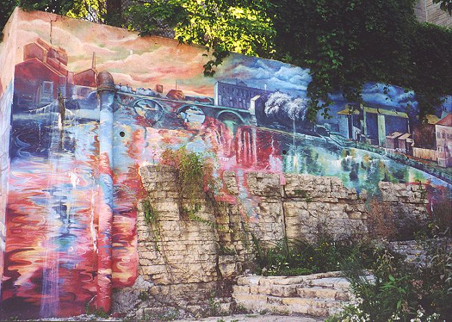
This was one of several murals in Joliet.
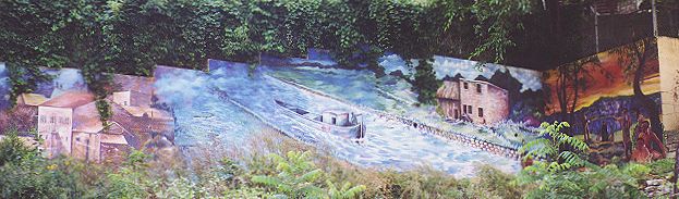
This mural showed the Illinois & Michigan Canal in its heyday.
I took a few pictures and hurried on toward Channahon. The bike route through Joliet had many turns, but I managed to follow it to the head of the Illinois & Michigan Canal National Heritage Corridor trail at Brandon Road.
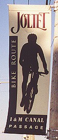
Banners marked part of the street route through Joliet.
The last time I had ridden this trail, about eight years earlier, the segment to Joliet hadn't even existed. I enjoyed the first mile or two on the crushed stone trail, but things went sour after that. I was heading straight into the southwest wind that I'd been tacking against all day, and worse yet, I was bonking. Big time. It wasn't quite as bad as in Rockford, but it wasn't much better. It took an eternity to get to Channahon as my speed dropped by several miles per hour. Finally, I reached the town and headed to a Casey's General Store where I bought a 32-ounce Gatorade. I drank a little and rode back to the Dari-Castle to wait. I used to eat there after long rides on my Raleigh hybrid when I pedaled the I & M Canal trail between Channahon and Morris in college. They always had great summer food and the smell coming from the burgers and hot dogs grilling on the Weber grills would draw you in from down the road. Unfortunately, it had been closed since at least 1999. It was for sale, but since it had been on the market for more than a year, its future looked bleak (note: in 2003, I drove past the site and found that the building had been razed and replaced by a Subway franchise).
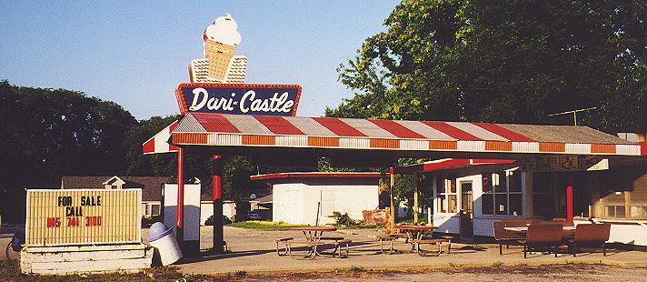
My refreshing post-ride meals at Dari-Castle looked to be a thing of the past.
I guzzled the rest of my Gatorade and read a book while I waited. By the time my ride arrived, I felt much better. This was the furthest distance I had traveled in one day with panniers, 94 miles.
![]()
![]()
![]()
Copyright © 2002-2013 David Johnsen. All rights reserved.