I always manage to spot a few large birds on the I& M Trail.
Illinois & Michigan Canal Trail RevisitedJuly 5, 2003Morris, ILApprox. 50 milesBicycle: Trek 6700 Ride Info: I& M Canal National Heritage Corridor |
|
The Illinois & Michigan Canal Trail is like an old friend to me. Although I rode more often on the Fox River Trail, Illinois Prairie Path and Virgil Gilman Trail in my younger days, the I & M holds a special place in my memory. I think it's the natural, peaceful and isolated setting of the trail that appeals to me the most, along with its rich history. Its infrequent street crossings and low traffic make for virtually stress-free riding.
The last time I rode on this trail was in August 2000 as part of my quest to become a Grand Illinois Trail (GIT) Trail Blazer. I pedaled all the way from Channahon to LaSalle and back in one day for a total of 128 miles. As I prepared my GIT web pages in 2002, I had trouble remembering which buildings, signs, locks, etc. were in which town. I think the out-and-back aspect had made it difficult to remember everything geographically. In the interest of accuracy, I resolved to ride the I & M Trail again. Since most of my confusion was between Morris and Ottawa, I planned to ride at least that segment out-and-back. If I felt good, I could extend it to Utica. I took along my digital camera and a notebook to keep track of where everything was. Being a purist, I did not use any of the photos from this ride to illustrate the old ride.
I decided to ride my much-neglected Trek 6700 mountain bike for several reasons: 1.) the I & M is a crushed limestone path, 2.) nowadays I have narrower tires on my hybrid that make it less suited for the surface than it was in 2000, and 3.) well, because my Trek was indeed much-neglected--I hadn't ridden it all year. The choice was good and bad. The big tires and suspension fork gave a cushy ride, as I expected, but my hands got a bit numb at times (I'm used to all those positions on drop bars). Worse, I learned that the seat is only good for about 40 miles before it starts to hurt. I haven't been keeping track, but I'm pretty sure this was the longest ride I've ever done on my 6700.
I got a very late start, and by the time I got to Gebhard Woods in Morris, it was 1:30 PM. Although much of the trail was nicely shaded, it still promised to be a hot ride. I stopped to read some of the nifty mile markers (placed circa 2000) that noted many historical tidbits about the canal. One of the most interesting facts that I didn't know was that the old towpath was converted to a trail way back in the 1930's by the Civil Conservation Corps. Since most of the trails I've seen in Illinois were built on railroad right-of-ways over the past 30-40 years, the I & M may be the oldest recreational trail in the state.
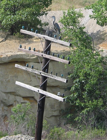
I am always surprised how few people I see on the I & M (except when I went for a long run there in February 2000, when I saw as few as I expected). All afternoon, I didn't see another cyclist going my way even though I stopped regularly to take notes and pictures. On average, I probably encountered one person per mile (walking or riding), mostly in towns--not that I'm complaining. I saw a lot of wildlife on this ride, most notably a blue heron that flew over my head and down the trail for a few hundred feet beneath the tree canopy. That was really neat to see. I also saw a beaver, a bunch of river otters and a couple more large birds.
|
|
|
I always manage to spot a few large birds on the I& M Trail. |
My original GIT report had indeed misplaced a couple of points of interest. Most notably, I had remembered a swinging railroad bridge as being near the grain elevator in Seneca when it was actually in Marseilles. By the time I got to Ottawa, I was a little beat from the heat, although an occasional cool breeze swept through the trees. I wasn't planning to go much further, so I broke one of my cardinal rules--never leave a town with empty water bottles. In retrospect, waiting until the return trip to refill was not a good idea, even if it was only a few more miles.
|
|
|
|
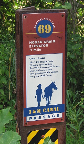
Mileposts gave the distance to the next landmark or town, plus a historical fact. |
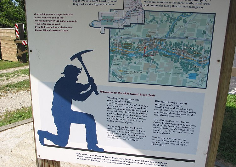
This sign in Ottawa told about the I& M Canal and the town. |
Based on the signs along the trail, it was 25-26 miles from Gebhard Woods to the lock west of Ottawa where I turned around. That estimate would have to suffice since my 6700 didn't have a cyclometer. After a quick walk around looking at the lock, I headed back toward Morris.
|
|
|
|
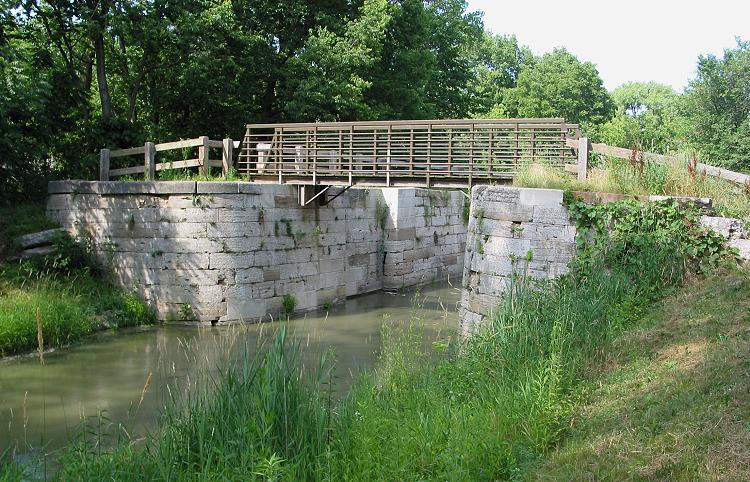
Lock 12 had a bridge across the top. |
This was the view from the bridge. Notice the concrete used in place of missing stone on the left. |
The trip home was faster because I had made all my research stops on the way out. Upon returning to Ottawa, I stopped at a gas station and bought two liters of water. I filled both water bottles and drank the rest. Still, the heat caught up with me around Seneca, making the last ten miles particularly tiring. I stopped occasionally to drink more water, reveling in the rush of coolness that I felt when the breeze hit my sweat-soaked jersey as I started riding again. I got back to the car about 5-1/2 hours after I started. That sounds pretty slow for a 50-mile ride, but that was clock time, not riding time.
|
|
|
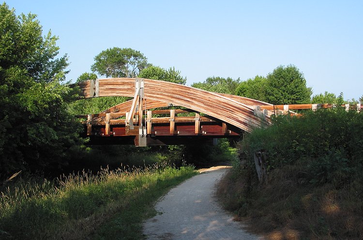
Duck! This unusual bridge crosses the trail and the canal just west of Morris. |
Copyright © 2002-2013 David Johnsen. All rights reserved.