
Friday, September 8, 2000 - Freeport to Rockford
Friday morning started with a great, filling breakfast at the Country Kitchen, only a stone's throw from the Super 8 where we had spent the night. We drove to the intersection of Henderson Road and Illinois 75 where I unloaded the bike in front of an old gas station. I was looking forward to a long stretch on the Pecatonica Prairie Path today. Since it was variously described as gravel or ballast, I expected something like the McHenry Prairie Trail.
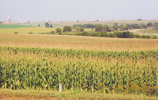
I was surrounded by fields of corn between Freeport and Rockford.
East of Freeport, I had a hard time finding the path. First I turned down a gravel road, but then I figured out I was supposed to go the other way. The other way wasn't a road at all, just a couple of ruts, and it looked to me like private property. I continued anyway, figuring I might be able to plead ignorance and avoid being shot for trespassing. I kept expecting to encounter the path, but the best I could find was a grassy right-of-way beneath some utility poles. It turned out that I had found the path, but the path was not suitable for my hybrid bike.
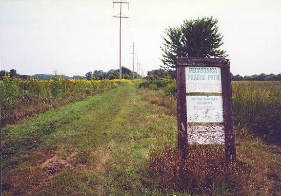
The Pecatonica Prairie Path was a bit too primitive for my bike.
I was disappointed, but the lightly traveled country roads were a pleasant alternative. I passed through tiny Ridott, then several miles and turns later, I came to Pecatonica. Years earlier, I had been through Pecatonica many times north and south on Pecatonica Road, but never from west to east. The Winnebago County Fairgrounds were on the west end of town, and shortly thereafter I saw an odd lawn ornament--a railroad signal and a small railroad car with a plastic Santa Claus inside. I zigzagged through the town until I came to Pecatonica Road near the banks of the Pecatonica River at noon. This was the last checkpoint I had to visit, except for the elusive Caboose Park. I rode up and down the main street and took a few pictures.
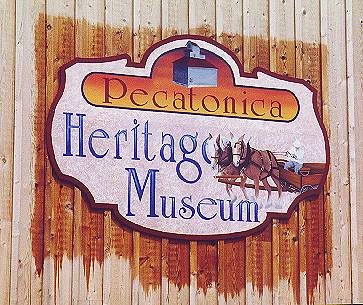
I took a picture of the Pecatonica Heritage Museum, but I didn't go inside.
There seemed to be more businesses than I had remembered. Perhaps Pecatonica was flourishing as a small-town alternative for Rockford workers. I headed east out of town past the post office on Third Street, which turned into Telegraph Road. This was a pleasant ride. Although the skies had been gray earlier, the afternoon sun was now beating down. A light breeze kept me cool. I nearly missed the turn onto Saunders Road, which I took over to Winnebago Road south. On the way to Winnebago, I took a picture of the Valhalla Pet Cemetery and thought it would be a nice final resting place for Scandinavian warrior dogs. As I mounted my bike once again, I was jolted out of that thought by a car passing perilously close to me just as a pickup truck passed it. I almost made a trip to the cemetery myself!
Thriving Pecatonica had surprised me, but I was stunned by the metamorphosis of Winnebago along US 20. There was a lot of commercial development there compared to ten years earlier. I waited a few minutes to cross busy US 20. Since Winnebago Road became narrow, I tried my luck on quiet village streets instead. The downtown area seemed peacefully oblivious of the fast food fanaticism up the road. I ended up at Cunningham Road, which led me all the way into Rockford. The southwest side of Rockford was not the nicest part of town. There was a lot of industrial development, much of it old and run-down looking. A few rough-looking characters milled about. I emerged from this depressed area and found the first piece of riverside path by following two bicycle police. It wound briefly north toward Chestnut Street, where I crossed the Rock River for the first time of the day. I had crossed this river several days earlier near the Quad Cities.
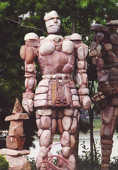
Heading north along the Rock River Recreational Path, people were very friendly, and I stopped to talk to several. It seems that the best way to meet people on a bike is to put on panniers. This just begs the question, “Where are you from?” which is naturally followed by, " Where are you headed?" This section of the trail was also graced by the best (and quirkiest) public art I saw along the entire GIT: the Rock Guardians of Rockford, four warriors made of reddish-brown rocks.
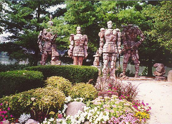
The Rock Guardians of Rockford were keeping the trail safe.
This Rock Guardian stood at attention.
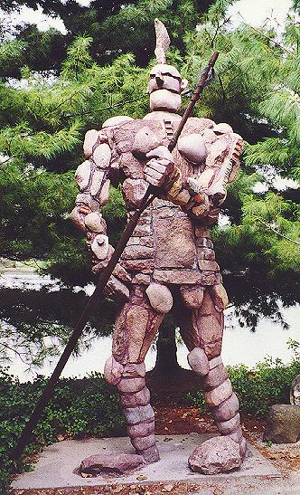
On the other hand, this Rock Guardian was poised for action.
From there, the trail alternated between dedicated paths and designated street routes.
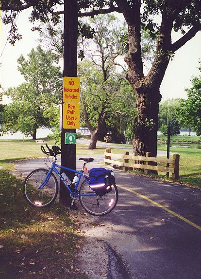
At least I knew the reflective strips on my panniers worked!
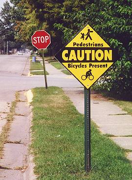
The on-street routes had warning signs.
I crossed back over to the west side of the Rock River, where I came to a sign for the “Pathway.” This sign was interesting because in addition to reminding cyclists and walkers to share the trail and dog walkers to clean up after their pets, the sign also depicted firearms and alcohol with red circles and lines drawn through them. I might have expected “no hunting” signs on a more rural path, but this was a little unnerving. Was this a common problem here?
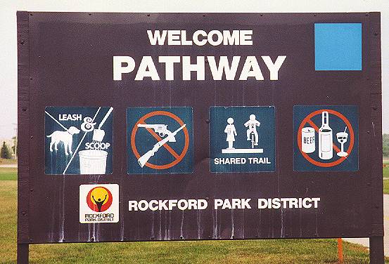
No guns allowed on the path!
At the north end of the Pathway, I discovered something I never knew existed--a toll bridge across the Rock River on Harlem Road. Cyclists got to cross for free, so I went over the Rock for the third time of the day. Heading north on Victory Lane (how appropriate for the last day of Trail Blazing!), I used a bike lane that really worked, as opposed to the dangerous ones in Chicago. The secret? " No Parking" signs. That meant no worries about opening car doors. One thing was just like Chicago, though. When I came to a school, parents were parked in the bike lane waiting for their kids. I was livid--motorists think they have a right to do whatever they please and screw the cyclists. Besides, it was a gorgeous, warm, sunny afternoon. Couldn't their kids have walked a block to their cars? No wonder juvenile obesity is on the rise. Little Johnnie walks 50 feet from the school doors to the minivan, and then they stop at McDonalds on the way home. Sheesh!
Just past the school, I turned right on Machesney Road, passing the Machesney Mall. After an exciting crossing of busy four-lane IL 251, I went through a few modest subdivisions. I definitely preferred the northeast side of Rockford to the southwest side. At Harlem High School, I rode onto the Willow Creek Trail on the south side of the building. This was a pleasant cruise with an occasional street crossing. I thought it was appropriate to be finishing the GIT on a trail rather than on a road. The Willow Creek Trail eventually headed into Rock Cut State Park. This part was really pretty, as the trail passed beneath a canopy of trees. This was the trail I had missed the turn for back in July.
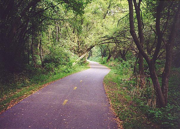
I enjoyed the shaded bike path through Rock Cut State Park.
The end of the trail came too soon. At the park road, my Grand Illinois Trail tour was essentially finished. I rode to the parking lot by the boat launch and there was my wife, right where we had planned. I rode 50 miles for the day. After five days of the last six on the bike, it felt strange to think that it was over, that there wasn't a route planned for tomorrow. I thought I would feel like raising my hands in victory as I completed the GIT, but I didn't. When the goal is the journey itself, the finish isn't a climax. It's just the end.
![]()
![]()
![]()
Copyright © 2002-2013 David Johnsen. All rights reserved.