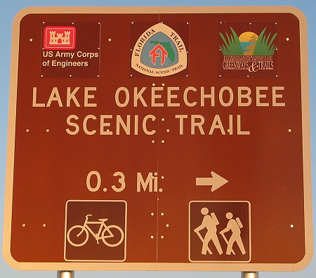
Lake Okeechobee Scenic Trail (LOST)
December 15, 2003
Okeechobee, Florida
53.2 miles
Bicycle: Bike Friday New World Tourist
Ride Info: Lake Okeechobee Scenic Trail
Lake Okeechobee Scenic Trail (LOST)December 15, 2003Okeechobee, Florida53.2 milesBicycle: Bike Friday New World Tourist Ride Info: Lake Okeechobee Scenic Trail |
|
The Lake Okeechobee Scenic Trail (LOST) is a 120-mile trail around " the Big Lake," as they call it (and it is big, about 730 square miles). The trail runs atop the Herbert Hoover Dike, which, along with a system of locks, is what keeps the Big Lake from spilling out across the vast flatlands of South Florida (which used to be flood plains or swamp before the U.S. Army Corps of Engineers came and altered the landscape). About 28 miles of the trail was blacktopped in fall of 2003 from the Kissimmee River to the St. Lucie Canal. A group of Florida cyclists recently formed the LOST Bicycle Club to support this new trail.
After a late start from my motel in Punta Gorda, I finally arrived at the west end of the paved section of the LOST around noon. The beginning of the trail looked like a driveway, so I followed it in hopes of reaching a parking lot. There was no parking area, but there was a barrier, so I turned back toward the road. Another vehicle was sitting in the grass just off the trail, so I pulled up alongside it and parked. I crossed my fingers that my car would still be there when I returned. I changed into my cycling clothes and prepared my bike. I took three big water bottles since I had heard that drinking water wasn't readily available (somewhat ironic on a trail surrounded by water). There wasn't much risk of getting lost, but I took along a map to keep track of how far along I was. By the time I was underway it was 12:30 PM. Since I had to ride more than 50 miles and be back before sunset around 4:30 (taking photos along the way, of course), I really had my work cut out for me. From what a member of the Touring list wrote about the mosquitoes at dusk (he described his exposed flesh as " black with mosquitoes" ), I definitely did not want to be out too late!
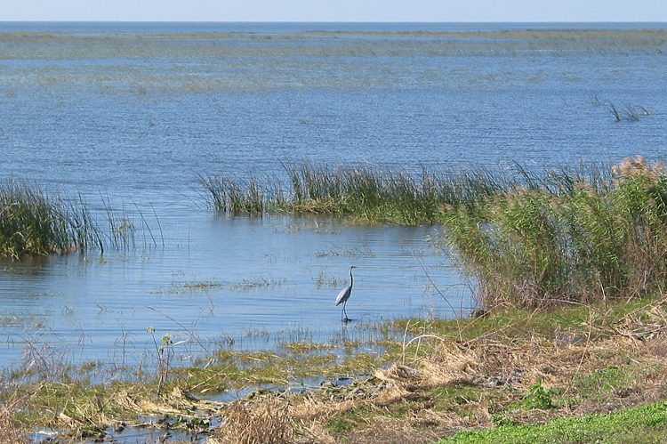
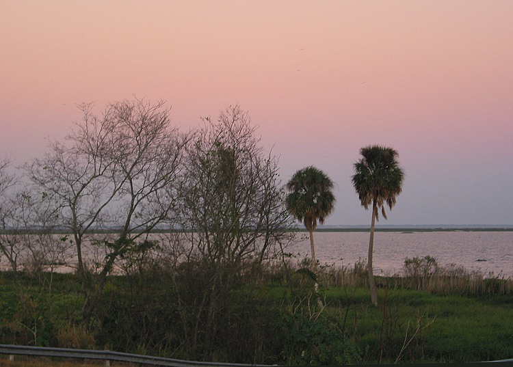
The best thing about riding atop the 34-foot tall levee was the view. Lake Okeechobee lay below me to one side and an outer canal was below on the other. Both bodies of water provide great habitat for birds and other animals. Sometimes the huge birds (various wading birds and vultures) swooped by, spreading their broad wings at eye level. The worst thing about riding on the dike was that there was no place to hide. Had I ridden the previous day, I would have been thoroughly soaked by torrential rains. Today I was at the mercy of the wind, with nary a tree at my level to slow it down. Because the trail curved around the lake, there was no way to avoid headwinds at some point.
|
|
|
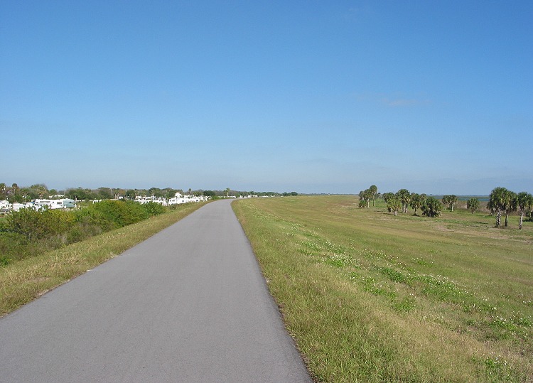
This was a typical view on the LOST. |
Today the forecast predicted winds only in the 7-10 mph range, but up on the levee they sometimes seemed twice that strong. I started out with a bit of a headwind, which made me happy because I knew it would push me along on the return trip when I really needed it. My immediate concern was some odd bike behavior: my chain seemed to keep slipping so that I was spinning without resistance. Since I hadn't ridden this bike in a while, I feared the worst. Then when I looked down, I noticed that the tensioner for my 3-speed Spectro hub was loose, practically dangling. I stopped, took up the slack in the line, and everything was fine. Thank goodness it was one of the few repairs I could actually handle!
I didn't feel good at first. Usually when I haven't ridden in a while, I start out a bit too fast, but today I was just dragging. The prospect of riding over 50 miles sounded like riding a stage of the Tour de France. After about six miles, I came to a lock at Taylor Creek where I had to leave the trail for a bit. It was a little confusing because there were no signs (the sign at the trailhead said there would be markers, but I saw very few), but it wasn't too hard to figure out. I had to ride over a short bridge with a steel grid on a semi-busy highway, but it wasn't that bad. Soon I was back on the trail.
|
|
|
|
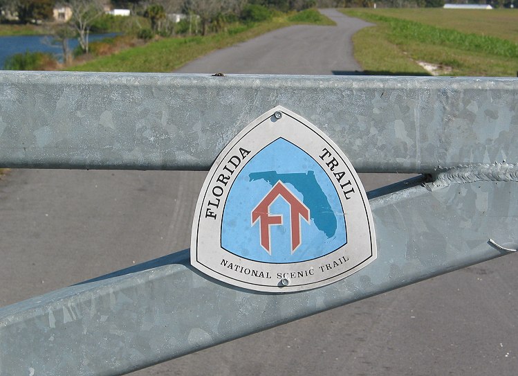
The LOST was part of the 1,300-mile Florida Trail. |
This was one of the locks along the trail. |
As I rounded the north end of the lake, the headwind changed to a crosswind. It slowed me down a little, but not as much as before. There were a number of workers shoveling dirt along the sides of the asphalt trail. As far as I could tell, they were filling in gaps between the asphalt and the surrounding levee. They didn't seem to be doing a very good job, as there were many gaps missing dirt. Anyway, they took up the entire path so I had to veer off onto the soft gravel, which was composed mostly of ground shells. My rear tire really bogged down in the soft gravel, and I feared that I had a flat. Fortunately that was not the case. After the first hour of riding (that's cyclometer time, not watch time), I had only covered 12.5 miles. Although the headwind was a factor, I knew I'd have to pick up the pace a bit to get back in time. On the bright side, I was feeling much better than I had at the beginning, and I was starting to find my groove.
|
|
|
|
The canal that ran outside the dike was picturesque. |
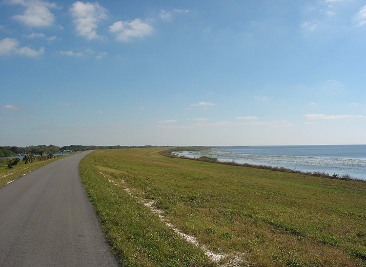
Lake Okeechobee was on the right, while the canal was on the left. |
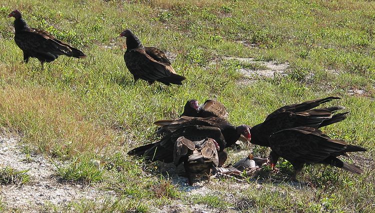
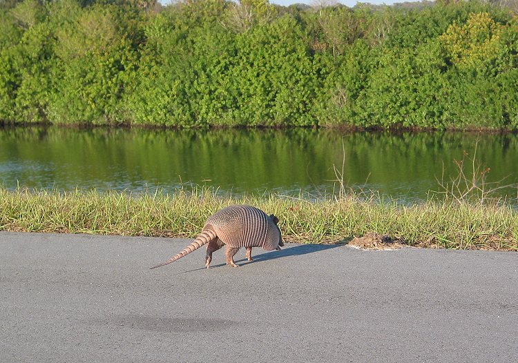
The next entertainment on the trail was provided by a bunch of vultures who were tearing apart a dead armadillo. It was like watching Wild Kingdom. Not only could I not look away, but I took pictures, too. I had never been so close to these birds before, and the loud < fwoomp> of their big wings flapping surprised me. Apparently eating lunch was more important than evading a human they let me get within a few yards before they scattered. I saw another armadillo squished on the trail a mile later. It occurred to me that I had never in my life seen an armadillo that was three-dimensional.
|
|
|
|
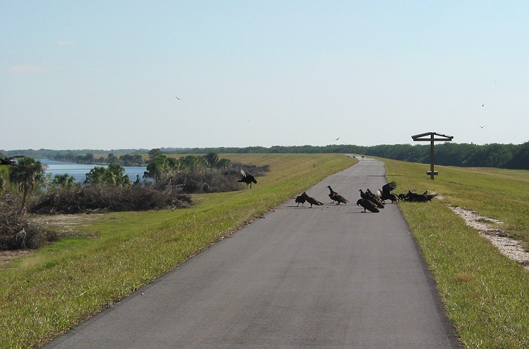
Up ahead, it looked like a vulture party. |
There were vultures everywhere. |
|
|
|
|
The vultures were tearing apart an armadillo carcass. |
There were a variety of wading birds, including this great blue heron. |
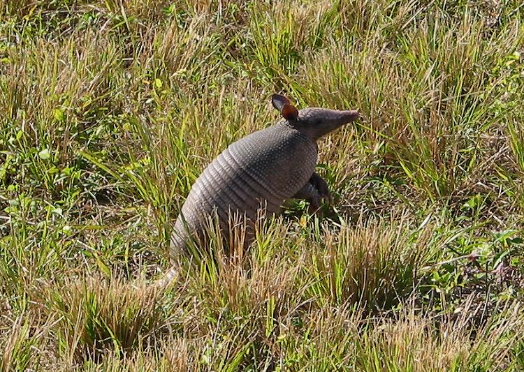
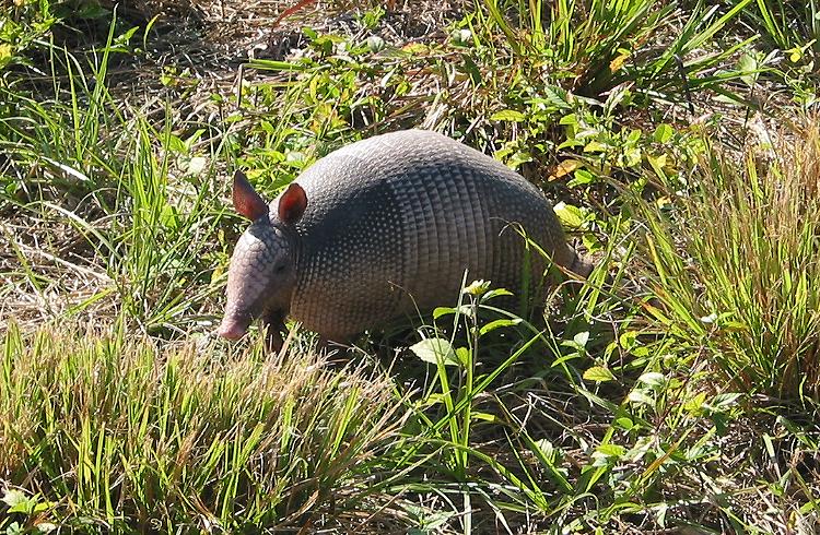
A couple miles down, something scurried about in the grass ahead. Finally, I saw a live armadillo. I think armadillos are so ugly that they're cute, if that makes any sense. The little guy seemed to wish that I would go away, but he didn't run. After taking a few photos, I left him to go about his business. Watch out for those workers' trucks, little guy!
|
|
|
|
I finally saw a live armadillo. |
The little guy watched me cautiously. |
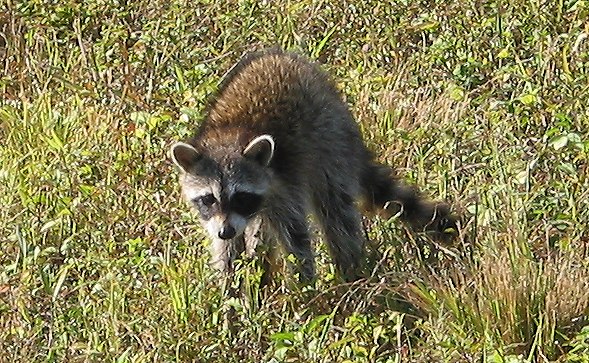
My next " wildlife" encounter was with a raccoon who reminded me of one of my dogs.
|
|
|
The raccoon was also wary of me. |
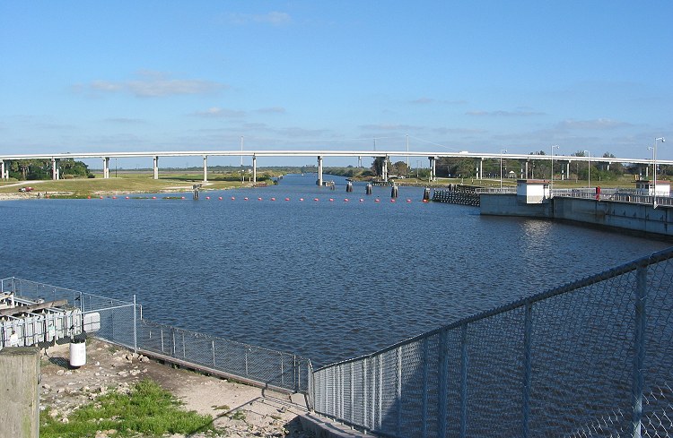
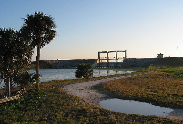
After 26 miles I came to the Port Mayaca Lock & Dam on the St. Lucie Canal. Although it was time to turn around, my eyes instinctively scanned for a way through. Just then, a locktender came out. I asked if I could get through, and he apologetically said that I couldn't because of security rules on government property since 9/11. He said he had argued about it, but orders were orders. I had figured as much, but I found it rather ridiculous. I mean, a lock on Lake Okeechobee probably isn't at the top of Al Qaeda's list of targets for mass destruction of American infidels. High security certainly was warranted at Hoover Dam, but not here. The locktender told me that the only way across the canal was on the tall highway bridge. There was a decent shoulder on the bridge, but the trail on the other side of the lock wasn't paved yet. It was getting a little late anyway, so I didn't bother going over to check it out.
|
|
|
|
The Port Mayaca Lock & Dam marked the end of the paved trail. |
I could tell from the bridge's height that the St. Lucie Canal was a navigable waterway. |
The locktender and I got into a surprisingly long and involved conversation about all kinds of things. He told me all about the waterways and how boats used the St. Lucie Canal to get from the Atlantic Ocean to Lake Okeechobee. At the other side of the lake, they could enter the Caloosahatchee River to reach Fort Myers and the Gulf of Mexico, cutting hundreds of miles compared to going down around the Florida Keys. He gave me a Corps of Engineers brochure that gave more information about the lake, its waterways and its habitat. After perhaps 20 minutes or more, I looked toward the setting sun and said that I had to get going before the bugs came out. " Yeah, the mosquitoes are still pretty bad," he said. He told me to come by and see him again if I ever came back that way, and he said he'd take me out for dinner!
|
|
|
|
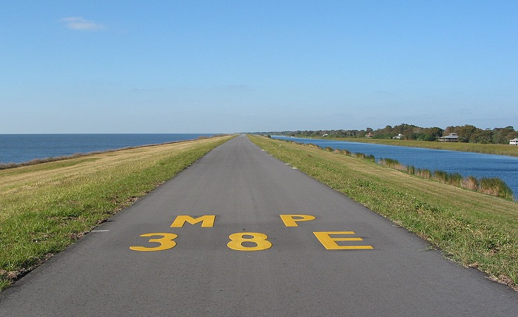
The mile markers for the LOST were painted on the asphalt. |
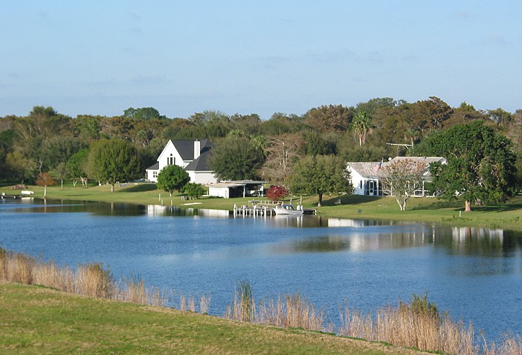
The canal shore was prime real estate since there was no private property directly on the lake. |
I had averaged a leisurely 13.5 miles per hour on the first half of my trip. Now I would have to pick up the pace a little if I didn't want to be covered with itchy red souvenirs by the time I got back to my car. I still stopped a few times, once for a turtle whose head withdrew into its shell as I approached.
|
|
|
|
A moment after I took this picture, the turtle drew its head into its shell. |
This little guy was on the run. |
|
|
|
Up on the dike, I saw the birds fly past near eye level. |
I was a little disappointed that I didn't see any alligators since I had heard there were many around the lake. Since I had seen them up close on canoe trips previously in Florida, I wasn't too crushed, though. Besides, I had a feeling that some of what I thought were rocks along the shore were really alligator backs. I just didn't investigate closely enough to identify one. There were more people using the LOST as I rode back than there had been mid-day, especially near the town of Okeechobee. Most of the people I met on the trail were friendly. This was a pretty laid-back area.
|
|
|
|
This was the closest I came to seeing or photographing an alligator. |
The setting sun cast shadows across this lock. |
The workers were still filling in dirt on the return trip. Once again, I steered around them onto the shell gravel. However, this time I had a bit of a surprise. As I attempted to get back on the road, my front tire caught on the asphalt ridge, turned about 30 degrees and skidded along. I like to think that my recent resistance training program played a vital role in keeping me upright as I used every muscle to yank at the handlebars. It would have been quite embarrassing to wipe out since there would have been half a dozen witnesses behind me.
I had another close call when I detoured around the Taylor Creek lock on the return trip. A bunch of kids were riding their BMX bikes on the sandy road heading toward me. I stayed to the right, and most of the oncoming kids stayed to their right as well. However, one kid stayed on my side, and he was completely oblivious to me. I tried to open my mouth to yell, but somehow I was mute. The other kids saw what was about to happen and yelled at their friend, who came out of his trance and steered out of my way. Phew!
As it got darker, my motivation grew. With a tailwind, I hammered hard for the last five miles around 21 miles per hour. I was literally racing the sun, trying to reach my car before the mosquitoes ate me alive. There seemed to be more bugs every minute as the sun descended, but I made it to the car before they got too bad. I quickly folded my Bike Friday and tossed it in the trunk. By time-trailing the last five miles, I raised my average speed to 14.1 miles per hour overall, covering 53.2 miles in 3:46. I was a bit tired but quite satisfied with what would be my last bike ride of 2003.
|
|
|
|
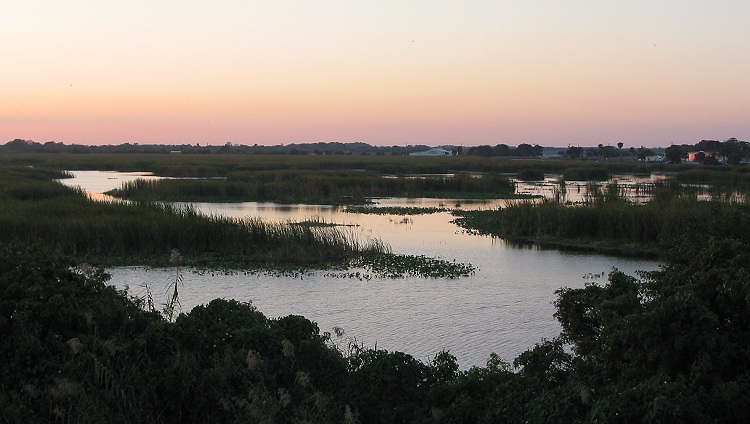
I paused just long enough on my race back to the car to take these pictures. |
Here is another pretty twilight picture. |
The Lake Okeechobee Scenic Trail was a pleasant ride. The trail was wide and uncluttered with excellent visibility. I was surprised by the vast number of birds and animals. I would highly recommend this ride to anyone visiting South Florida. The entire 120-mile circumference should be paved by the end of 2004. With access to a number of motels, campgrounds and restaurants around the lake, a cyclist could get LOST for days.
Copyright © 2002-2013 David Johnsen. All rights reserved.