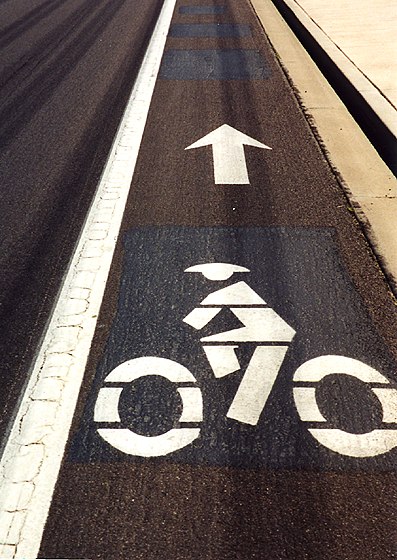
I noticed that the cyclists marking Mesa's bike lanes wore helmets.
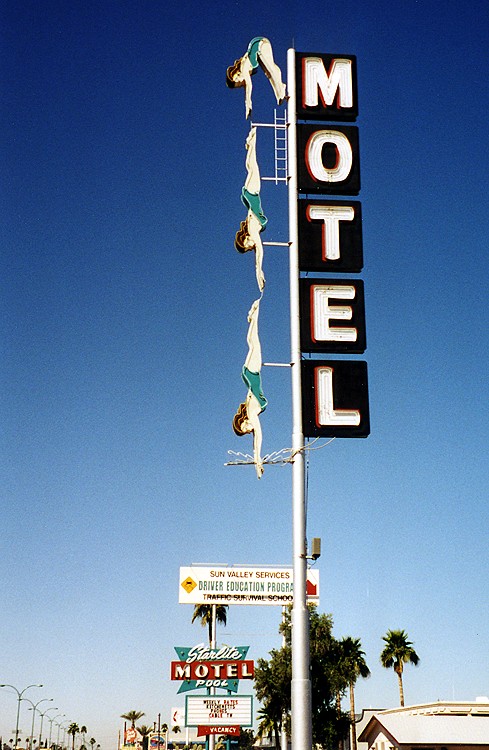
On this well-known Mesa motel sign, the neon swimmers sequentially light up as if diving into a pool.
Monday, March 19, 2001 Usery Pass And Saguaro Lake
On Monday, I decided to sleep in a bit and eat breakfast with my family. Knowing my tastes, they chose Waffle House across the street. Two waffles, a double order of hash browns (scattered, covered, and chunked), and two vanilla Cokes later, I waddled out of the restaurant and back to the motel to get on my bike. This day’s ride had three parts: a long and flat ride through Mesa from the west side to the east, miles and miles of climbing and descending on Usery Pass and Bush Highway to Saguaro Lake and back, then another long and flat ride through Mesa in the other direction.
This was the day I really began to appreciate the bike-friendliness of Mesa as compared to Chicago. Although it took awhile to cruise 20 miles across town, it was a pretty easy ride.
|
|
|
|
I noticed that the cyclists marking Mesa's bike lanes wore helmets. |
On this well-known Mesa motel sign, the neon swimmers sequentially light up as if diving into a pool. |
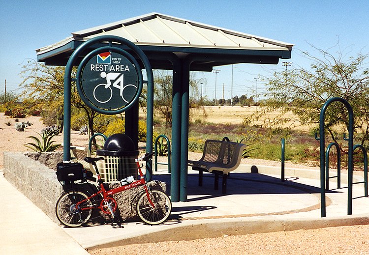
At Red Mountain Park on the east end of town, there was even a cyclist rest area with shaded benches and a repair post. The only thing missing was water, but I found that inside a nearby park building. Good thing, since my water bottles were nearly empty already.
|
|
|
This was the Red Mountain Park bicycle rest area. |
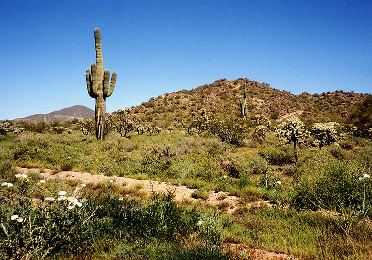
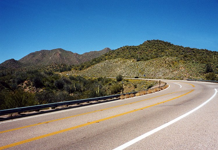
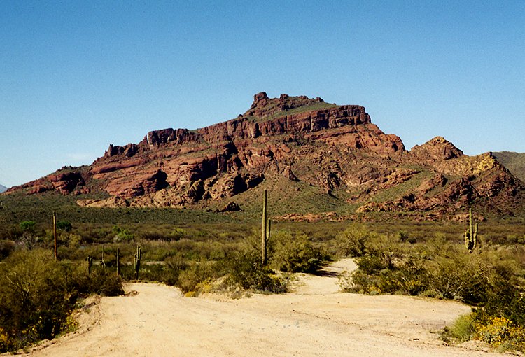
Soon I was on Usery Pass Road climbing toward, you guessed it, Usery Pass. I had heard that this was a popular route for local cyclists, but I was astounded to see bike lanes. I had never seen a bike lane outside of town before. This was a decent climb, enough to feel but not suffer. It wasn’t nearly as steep as the previous day’s killers in Fountain Hills, but it was longer. I stopped a few times to take pictures of the fantastic desert scenery. It was much greener than I expected, with a variety of cactus and wildflowers.
|
|
|
|
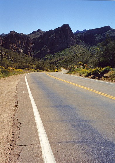
This was the view in Usery Mountain Recreation Area. |
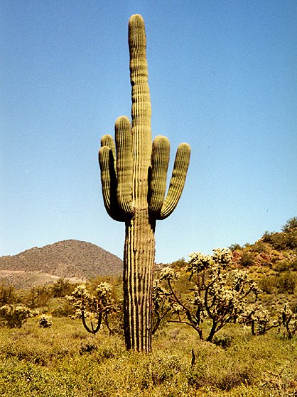
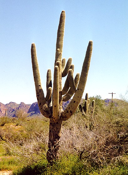
This trip was the first time I saw native saguaros. |
|
|
|
|
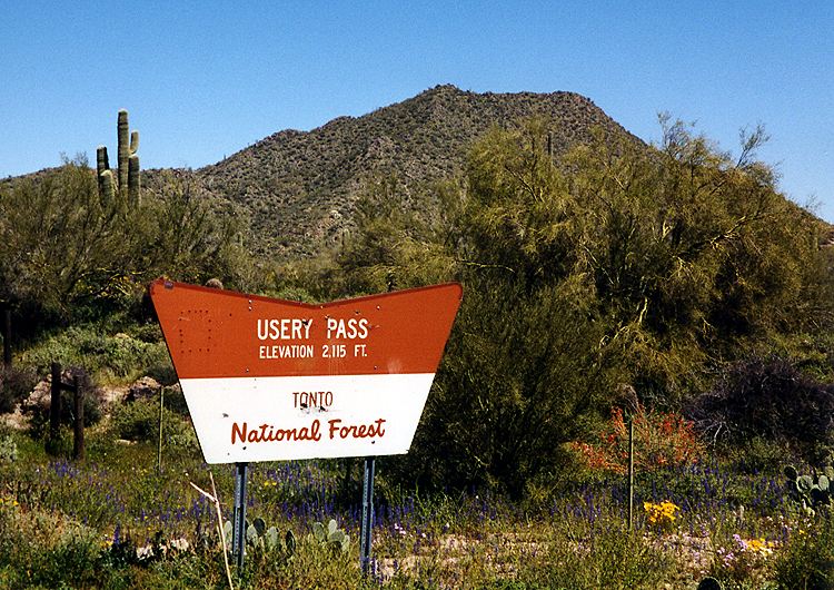
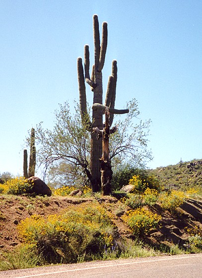
I entered Tonto National Forest, and a sign marked the elevation of Usery Pass: 2,115 feet. |
Compare this cactus with the one above. |
Another long descent followed, not as long as Sunday’s on Rio Verde Drive, but steeper. I thought it might be a great challenge to climb this side on the return trip, but I had plans to check out a different climb instead. At the bottom of the hill was a stop sign at Bush Highway.
I headed east on Bush Highway toward Saguaro Lake and found myself climbing again. This went on for roughly 7-8 miles. Temperatures were in the low 80’s. The heat didn’t bother me much, but I drank a lot. There were a few false downhills, judging from the effort that it took to keep going. As I began to run low on water, I wondered how much further it was. The climb got steeper, but I managed it pretty well, just chugging along steadily.
|
|
|
Finally, I came to the turn for Saguaro Lake. This was a steep downhill, and I had to brake to avoid running into the car ahead of me. I was thrilled to find a carryout counter next to the restaurant. It took a while to find a good place to lock up, and I probably could have walked the bike into the concession area since the corridors were wide. There wasn’t much to choose from, so I ordered a hotdog, a large Coke, water, and a Gatorade.
Feeling quite refreshed, I headed back up the hill to Bush Highway. Along the way there was a saguaro that was bent as if it were pointing the way out. I vaguely remembered seeing a saguaro doing that in a cartoon.
|
|
|
" Just go right up that hill..." |
At the highway, I decided that since I was feeling good, I might as well continue the climb I had started, so I turned right (away from Mesa). Perhaps a mile down the road, I reached the top of the hill and turned around. The descent was steep enough that I soft-pedaled for a few miles. I got back to Usery Pass Road much faster than I expected. I resisted the urge to scale Usery Pass from the north. My reward was a pleasant cruise alongside the Salt River on Bush Highway. This was capped by great vistas of Red Rock (you guessed it--a big outcropping of red rock) and a climb up Spook Hill.
|
|
|
|
This was Red Rock viewed from across the Salt River. |
Further up the road, the river wasn't visible. |
Soon I was back in Mesa. Even the streets that were less bike-friendly seemed nice compared to Chicagoland riding. After I zigzagged southwest across town (no diagonal streets in Mesa!), I still had time so I kept riding around. Even though it was rush hour, riding wasn’t too bad. I went to an awesome map store called Wide World Of Maps, then headed back to the motel. I would guess it was around 75-80 miles total for the day, not a bad follow-up to a century.
|
|
|
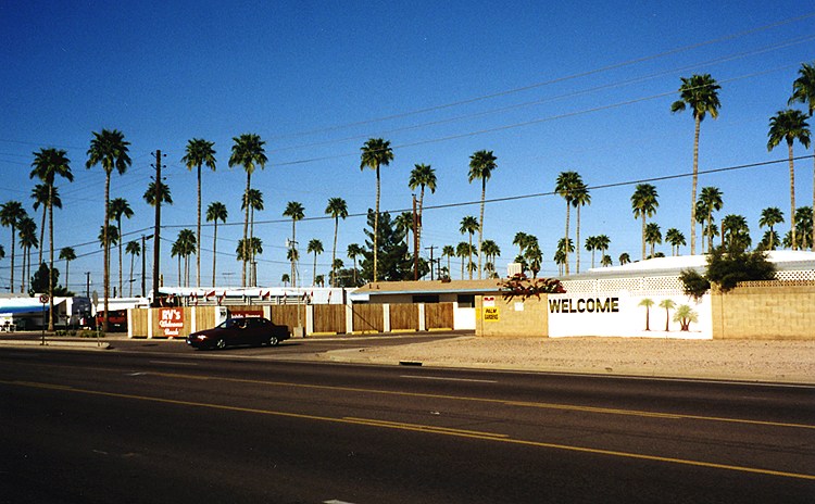
This distinctive RV park in Mesa had lots of tall palm trees. |
Next Day: A Day With Sammy And Alice
Return to Central Arizona 2001
Copyright © 2002-2013 David Johnsen. All rights reserved.