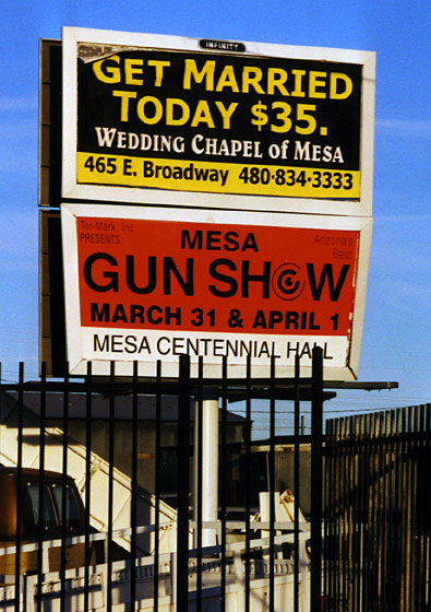
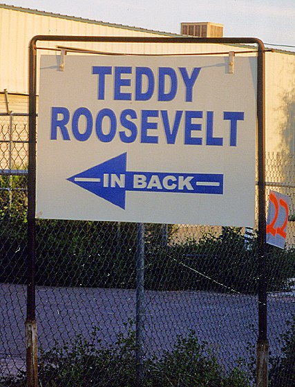
" Mesa: Your Shotgun Wedding Headquarters."
This sign lied. He wasn't back there.
Sunday, March 18, 2001 A Desert Century
Sunday morning I woke up before dawn and prepared for a long day in the saddle. The earlier I started, the longer I could ride, and I wanted to be back for dinner. By 6:30, I was headed north toward Scottsdale. There was a chill in the air, but I knew it wouldn’t last for long.
|
|
|
|
" Mesa: Your Shotgun Wedding Headquarters." |
This sign lied. He wasn't back there. |
|
|
|
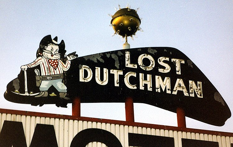
The Lost Dutchman was one of Mesa's many vintage motels. |
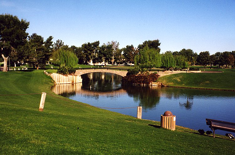
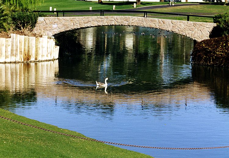
Once I got across the river, I picked up the bike path along Indian Bend Wash. The trail wound through a golf course or two (there are golf courses everywhere in Scottsdale), and I imagined that my helmet might save me from a stray golf ball.
|
|
|
|
" Scottsdale: Golf Capital Of The Desert." |
. |
|
|
|
" Hey, why is that guy with the weird-looking bike taking a picture of us?" |
Since I was riding through a wash (basically a drainage ditch), there were ominous signs everywhere that warned, " Do not enter when flooded." According to the weather forecast, that wouldn't be a concern today. This was a pleasant Sunday morning cruise. It wasn’t crowded and was fairly easy to follow, although I occasionally wandered off onto a dead-end spur to a crossroad. When the path ended, I hit the roads. Some were fairly busy, but I managed. As in Mesa, most of the busy streets had no parking, so I was able to stay far to the right. Most Arizona drivers were more polite to cyclists than Illinois drivers, and I’d be willing to bet that a good number of the rude ones were former Illinoisans!
|
|
|
|
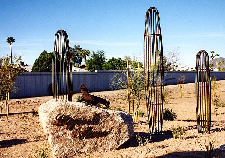
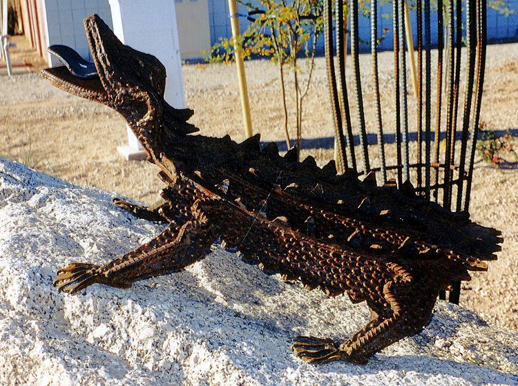
Lizard Acres was created by artist Joe Tyler to decorate a water detention basin in Scottsdale. |
For more about these sculptures, visit http://www.scottsdalepublicart.org/collection/lizardacres.php. |
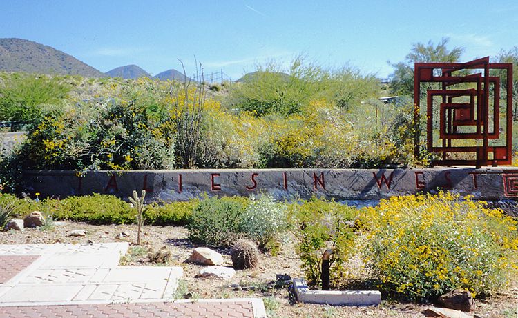
I rode to Taliesin West, Frank Lloyd Wright’s former home, purely by chance. I followed the narrow road up to the building, but I decided I would rather ride than go inside.
|
|
|
|
This road on the northeast edge of Scottsdale led to Taliesin West. |
This marked the entrance to Taliesin West. Alas, I had camera trouble after taking this photo, so it was the last of the day. |
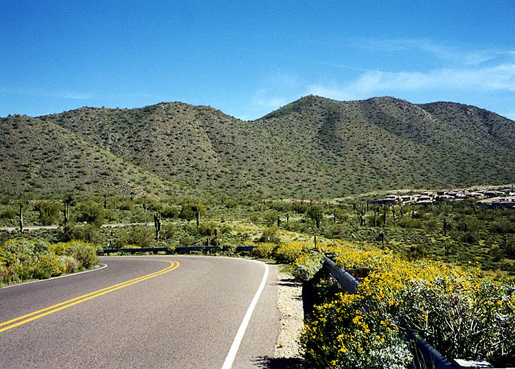
Instead, I explored a very hilly subdivision nearby. After I had my fill of hills for the moment, I continued north, zigzagging along whatever streets I felt like riding. Finally, I figured out that it was time to make a more concerted effort to get out toward McDowell Mountain and back to the motel on time. I headed north on busy Pima Road, which luckily had a bike lane. After noon, I found a bike shop in a strip mall out on the edge of Scottsdale, Pinnacle Peak Cyclery. Although the sign said they didn't open until 1:00, I saw a guy inside, so I went in. He had a keen interest in my Bike Friday and adjusted my rear derailleur so I wouldn’t have another mishap like the day before. They had great team jerseys for sale (the store sponsors local road and mountain bike teams), but unfortunately, they didn’t have my size. I bought a spare tube, though.
When I decided I'd gone far enough north, I turned east on Rio Verde Drive. To my surprise, this road was one long downhill ride (nine miles!). I saw several cyclists heading the other way, some not looking too comfortable with the endless climb. I finally came to a stop sign. I was going to turn south and head back toward Mesa, but then I noticed a food vendor parked by the side of the road. His cart said “Road Weenies” and he sold hotdogs, Italian sausage, Polish sausage and best of all, soft drinks and water. I bought a Polish, a Coke and a bottle of water. The vendor and I talked while I ate. It turned out that he used to live near my current home, albeit eight years before I was born. I enjoyed hearing him tell about the old neighborhood. Since this intersection was near the edge of my metropolitan Phoenix bicycle map, I dubbed him " The Man at the End of the Map." He and several cyclists who had stopped for lunch were surprised to hear that I had ridden all the way from Mesa. He told me I wouldn’t get back there until 6:00, not good considering I was supposed to be back by 5:30. The other cyclists informed me that it was payback time for that nice downhill I had enjoyed there was plenty of climbing all the way through Fountain Hills, a good ten miles.
The climbs weren’t too bad considering that I was already a bit tired from riding 60-70 miles. This was a great cycling road that skirted the east side of McDowell Mountain Park. Suddenly, my front tire felt funny, and I slowed to a stop. There was an ugly shard of metal protruding from the tread. With great trepidation, I pulled it out. I was expecting a psssssssshhhhh, but incredibly, the tire didn’t leak. Every mile or so, I’d look down and be happily surprised that my front tire was still full. At the south end of Fountain Hills, I hit some really steep hills. I dropped all the way down to my lowest gears and took several breaks, but I managed to climb them. At least it proved that I had chosen suitably low gearing for my new bike. When the road ended at Shea Blvd., I headed east to pick up SR 87 for the quick ride back to Mesa, stopping first at a gas station for fluids. Much like George Thorogood’s classic " One Bourbon, One Scotch And One Beer," my typical purchase became " One Water, One Coke And One Gatorade." I drank the 32-ounce fountain Coke, poured the leftover ice and the water into my water bottles and strapped the Gatorade onto my rack pack. My front tire still looked fine.
SR 87 was a busy four-lane highway with a 65 mph speed limit, but its shoulders were wide and generally clear of debris. There were many narrow irrigation canals in the Phoenix area, which I found strangely fascinating (see my Grand Illinois Trail web pages for more about my canal fetish). I stopped for a break where SR 87 passed over one. I took a few swigs of water and looked down at my tire. My luck had run out. At least I knew exactly where the flat was because the shard of metal had left a small but visible cut in the tread. As it turned out, I didn’t even have to remove the tire completely to patch it. I didn’t have a pressure gauge, so I just filled the tire as much as I could. My new Crank Bros. mini-pump had a dual setting for high and low pressure, so it wasn’t too hard to get up toward 100 psi compared to other mini-pumps.
There were a few tight spots with road construction, but otherwise it was an uneventful ride home from there. SR 87 crossed the Salt River and turned into Country Club Drive, which took me right to the motel. I arrived at 5:00, a full hour before The Man at the End of the Map had predicted, despite stopping for the flat tire. I had to guess my mileage because I didn't have a cyclometer on my Bike Friday yet. On my Phoenix bike map, I roughly measured 93 miles for my basic route with the curves straightened out. I was confident that my actual mileage was at least 100 miles, my first century of the year (in fact, my first century of the new millennium).
|
|
|
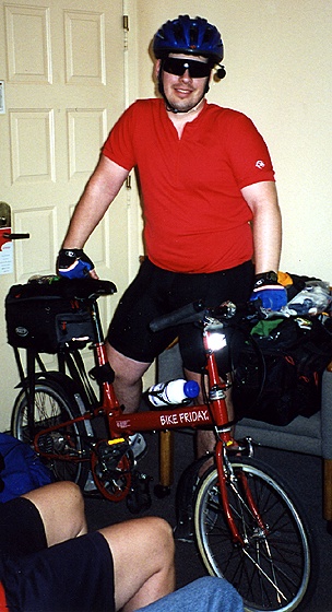
Mom took this picture in the motel room after my ride. |
Next Day: Usery Pass And Saguaro Lake
Return to Central Arizona 2001
Copyright © 2002-2013 David Johnsen. All rights reserved.